Quantcast
Channel: Don Croner’s World Wide Wanders
Viewing all 431 articles
Browse latest View live

Uzbekistan | Khwarezm | Mizdakhan | City of the Dead

$
0
0
From Janpiq Qala we proceeded forty-eight miles as the crow flies downstream to the no-account city of Nukus, which I had visited before and certainly did not want to visit again. Hurrying through Nukus we crossed the Amu Darya River and drove about twenty-five miles southwest to the immense burial grounds of Mizdakhan. Apparently there was a settlement on this site as far back as the fourth century b.c. when Khwarezm was freeing itself from the Persian Achaemenid Empire. This original settlement was destroyed by fire around the end of the second century b.c. Another settlement existed here between the first and fourth centuries a.d. but it too was eventually destroyed by agents unclear. Around the second century b.c. a cemetery was established here and after the settlements disappeared the area eventually became devoted to burials. Between the fifth and eight centuries it became an important Zoroastrian burial site with many ossuaries containing bones which had been had stripped of their flesh at places like the Tower of Silence which I had visited earlier. There are also some Christian burials here dating to the seventh century. These probably involve members of the Melkite sect who had settled in Khwarezm. Interestingly they had apparently adopted Zoroastrian burial customs and interred the bones of their dead in ossuaries. 

In 712 a.d. the Islamic Arabs conquered the area, destroying many of the local Zoroastrian fire  temples and killing Zoroastrian priests. Zoroastrian burials continued until about the ninth century, however, indicating that the Arabs had not been able to immediately stamp out Zoroastrianism.  The first Muslim burials date to around the ninth century. From then on the necropolis grew exponentially. I have not seen any figures on how many tombs are in the necropolis, but there are certainly thousands and perhaps tens of thousands. Many people with the means to do so built mausoleums the size of houses.

Among the notables is the tomb of Shamun Nabi. According to legend the tomb of this well-known local holy man, like the Tomb of Khizr in Samarkand, continues to get longer each year. It is already over 50 feet long and supposedly still growing!
The seven-domed mausoleum of Shamun Nabi (click on photos for enlargements)
The ever-growing tomb of Shamun Nabi
Not far from the tomb of Shamun Nabi is the Mazlum Sulu Khan Mausoleum. This is especially interesting since it dates back to the time of the last Khwarezmshahs, either Tekesh (r. 1172–1200) or his son Mohammed (r. 1200–1220), at the end of the twelfth century or the beginning of the thirteenth. Thus it was quite new when the Mongols arrived in the area in the winter of 1220–1221. It is usually kept locked, but an old caretaker appeared out of nowhere and offered to open it up for my inspection. He did not speak English but we were able to communicate in Russian.  

The mausoleum is fairly unusual in that it is underground. It was a blistering 85º F outside but walking down the steps into the main room of the mausoleum was like entering an air-conditioned hotel room. The caretaker said it stays cool throughout even the hottest days of summer. The cupola over the underground room may have been destroyed during the Mongol invasion but it was later rebuilt and the mausoleum eventually became an important pilgrimage site. Still later it became a hangout for shamans. According to a legend retold by Khwarezm Qala Cognoscente David Richardson, the mausoleum is named after the daughter of an important local official, apparently back when the mausoleum was built: 
Mazlum Sulu Khan was supposedly the beautiful daughter of the governor of Mizdahkan. Despite being desired by all of the local eligible bachelors, Mazlum Sulu Khan was in love with a poor builder. Frustrated by the lack of a suitable groom, the governor foolishly announced that he would give his daughter’s hand to the young man who could build a minaret as tall as the sky in the space of one night. Naturally the poor builder succeeded in constructing the minaret, but when he came to the palace for the hand of his bride the following morning, the governor refused. The dejected young man jumped from the top of the minaret only to be followed by the beautiful and distraught Mazlum Sulu Khan. The heartbroken governor ordered that the minaret be destroyed. The young lovers were buried together and a mausoleum was constructed above their grave using the bricks from the ruins of the minaret.   
This, however, is supposedly only a legend, and it remains unclear for whom the mausoleum was actually built. But if it is just a legend then who is buried in the small tombs on which someone has placed artificial flowers? I tried to get more information from the caretaker, but bizarrely enough he launched into a long monologue about the ex-boxer Mike Tyson. This is the fifth or sixth time I have heard about Mike Tyson in Uzbekistan. Next to Obama he appears to be the best known American in the country. The only other person who comes close is Beyonce. 
Entrance to the underground chamber
Underground chamber with a tomb decorated with flowers
View of the dome over the underground chamber
Another tomb with flowers. Who is actually buried here is unknown.
Madrassa destroyed by Amir Timur when he swept through Khwarezm in1388. The bricks stacked in what looks like tiny ovoos adds a peculiarly Mongolian touch to the scene. 
City of the Dead:These are all tombs
City of the Dead
City of the Dead
City of the Dead
City of the Dead
Just a mile or so from the necropolis are the ruins of Gyaur Qala, not to be confused with the Gyaur Qala farther upstream on the Amu Darya. It was destroyed by Chingis Khan’s sons Ögedei and Chagatai in the winter of 1220-1221 either before or after they sacked the Khwarezm capital of Urgench, fifteen miles or so to the southwest. I would of course love to visit Urgench (now Konye Urgench) but it is on the other side of the border in Turkmenistan and I do not have a visa for Turkmenistan. 
Ruins of Gyaur Qala

Turkey | Istanbul | Hagia Sofia | Tomb of Enrico Dandolo

$
0
0
Wandered into Hagia Sofia in Istanbul to see the tomb of Enrico (Henrico) Dandolo. As most of you know Dandolo was the Venetian doge who engineering the Fourth Crusade which resulted in the sack of Constantinople in 1206. As John Julius Norwich put it in Byzantium: The Decline and Fall, volume three of his magisterial history of the Byzantine Empire:
There are few greater ironies in History than the fact that the fate of Eastern Christendom should have been sealed—and half of Europe condemned to some five hundred years of Muslim rule—by men who fought under the banner of the Cross. Those men were transported, inspired, encouraged, and ultimately led by Enrico Dandolo in the name of the Venetian Republic; and, just as Venice derived the major advantage from the tragedy, so she and her magnificent old doge must accept the responsibility for the havoc that they have wrought on the world. 
Interior of Hagia Sofia (click on photos for enlargements)
The tomb of Enrico (Henrico) Dandolo is on the second floor loge of Hagia Sophia
The tomb of Enrico Dandolo

Turkmenistan | Ashgabad | History Museum

$
0
0

My initial interest in Turkmenistan was spurred by my researches into the Mongolia Invasion Of Khwarezm, the ancient realm straddling the lower Amu Darya River and its delta where it flows into the Aral Sea, in the winter of 1220-21. The territory of old Khwarezm is today encompassed by both Uzbekistan and Turkmenistan. I had earlier visited Khiva, Janpiq Qala (fortress), and Gyaur Qala in the part of Khwarezm now in Uzbekistan, all sites attacked by Chingis Khan’s sons Ögedei and Chagatai as the Mongols swept through the region. The  old Khwarezm capital of Gurganj is in Turkmenistan, however, eight and a half miles from the border and thirteen miles from Gyaur Qala. The ruins of Gurganj are close to the city of Konye (old) Urgench, not to be confused with the new city of Urgench in Uzbekistan. I of course wanted to visit Gurganj, which had put up the fiercest resistance of any city the Mongols had up to that point in time encountered in Islamic Inner Asia, but  since I had no Turkmenistan visa and only a single entry Uzbek visa I was unable to cross the border. 

Immediately upon my return from Uzbekistan I launched plans to enter Turkmenistan via its capital of Ashgabad and travel north to Konye Urgench. I soon learned that travel by foreigners in Turkmenistan was not a stroll in the park. A visa could only be obtained after a government-approved tourist agency had obtained a Letter of Invitation from the Turkmenistan authorities and most if not all travel agencies will not get you the Letter of Invitation unless you arranged your entire trip, including transportation and accommodations, through them. So it appeared pretty much impossible just to wander about on your own.  I contacted a travel agency in Ashgabad and told them that I wanted to visit Konye Urgench plus a number of other historical sites, some of them directly connected with the Mongol invasion and others not, which had turned up in my various researches. They very quickly responded with a detailed fourteen-day itinerary including most of the places I had mentioned and a few which they thought might be of interest to someone like myself who appeared to have an historical turn of mind. I had not heard of some of these places, but since they appeared to be on the route to the places I was interested in I thought I might as well check them out also. Since it would be difficult if not impossible to visit all these place in fourteen days using Turkmenistan’s dicy public transportation system they suggested that I charter a vehicle for the entire fourteen day trip. The travel agency’s drivers, I was told, did not speak English, but since my driver would simply be taking me on the approved itinerary, with pre-arranged stops each night, they did not anticipate any problems.

Actually this plan appealed to me. I had used drivers in Uzbekistan who did not speak English and had managed to communicate with them using my very basic Russian. I expected that my driver would also speak some Russian, since Turkmenistan like Uzbekistan was once part of the Soviet Union and Russian was widely taught in its schools and still used by many segments of the population. If the driver did speak Russian we could deal with simple logistical matters when necessary but the rest of the time I could just sit back and indulge in my own historically inspired revelries and daydreams without the tiresome personal interactions required by the presence of a guide or translator. In short, I would be pretty much on my own, except for the driver who would also be acting as my escort. 

I emailed a copy of my passport, photos, and personal information to the travel agency and two weeks later received the much-coveted Letter of Invitation. I was to present this to immigration officials at the Ashgabad airport and receive my visa there. Since I was in Ulaanbaatar, Mongolia at the time, I flew from there on the direct flight to Istanbul (there is a one hour stop  in Bishkek, Kyrgyzstan, but you do not have to change planes). Surprisingly enough—at least to me—Turkish Airlines has two flights a day seven days a week to Ashgabad. After three days in Istanbul examining the recent acquisitions of my favorite Carpet Dealers and checking the  prices of spices in the shops lining the alleys just west of the Egyptian Bazaar (the best quality Iranian saffron is now selling for $925 a ounce), I took the metro to the airport for my 1:00 a.m. flight to Ashgabad. I would make my purchases on the return leg of the trip. 

When I arrived at the airport at 11:00 p.m. I was a bit disconcerted to find lined up at the business check-in counter forty or fifty people, mainly women, all with carts piled high with monumental mountains of baggage. My God, were all these people flying business class? It turns out not. They were small-time traders from Turkmenistan who had flown to Istanbul to buy goods for resale in Ashgabad. Since the business class check-in area was not much in use at this time of the night they had been herded here to get their heaps of luggage checked in.  I and some Chinese men flying business was shown to the front of the line and quickly checked in. The three-hour, 1570-mile flight from Istanbul to Ashgabad left at 1:15 a.m. It was sold out. Eight seats in the sixteen-seat business section were occupied by Chinese businessmen attending some energy-related conference. 

After about two hours we passed over the middle of the the Caspian Sea,  250 miles wide at this point, its inky black surface dotted with brightly lit offshore drilling platforms and gas flares. After another half hour we began our descent through heavy cloud cover to Ashgabad. It was raining hard when we finally touched down at 6:20 a.m. local time. Given all the rigamarole involved in getting an letter of invitation to the country, the procedure at the airport was quite easy. I presented my letter of invitation and was very quickly given a visa. There were no entry or customs documents to fill out and my luggage was x-rayed but not opened.  One of the women operating the x-ray machine said in English, “Have a nice stay in Turkmenistan.”

In the reception area I was met a young man from the tourist agency who whisked me away to my hotel. I had been told earlier that my room would not be available until noon. The plan was to stash my luggage at the hotel, have breakfast, then take a tour of the city in the morning until my room was free. I have very little if any interest in history which postdates the fall of the Ottoman Empire, and since Ashgabad is a fairly new city founded in the 1880s by Russian colonialists I doubted that there was much I would want to see.  The alternative, however, was to sit in the hotel lobby until my room was available. 

My driver, a young man in his twenties, spoke no English but as I had expected he spoke Russian. The rain was coming down even harder as we cruised down the wide multi-lane streets, mostly deserted at this hour of the morning. A bewildering array of huge white buildings reared up out of the rain and fog: the immense gold-domed Presidential Palace fronted with cascades of water; the likewise enormous many-columned Turkmen Parliament building; a vast Exhibition Center set in immaculately landscaped park complete with pools and fountains; the Academy of Sciences Building; the Carpet Museum, which according to my driver contains the largest handmade carpet in the world, duly recognized in the Guinness Book of World Records; a  children’s park containing what at first glance appeared to be a gigantic white candy life-safer but is actually the world’s largest ferris wheel; blocks of twelve-or-more-story luxury apartment buildings which seemed to stretch off into infinity; and much, much else. All the buildings seemed oversized, and all were white. The whole effect was almost hallucinatory. I had come to visit thirteen-century historical sites but seemed to have dropped into some futuristic city designed by a Turkic reincarnation of Albert Speer on acid. That I been up for over thirty hours and had guzzled a least half a gallon of coffee in the business lounge in Istanbul, on the plane, and at breakfast in my hotel certainly didn’t help my mental state. 

Having seen enough of Ashgabad for the moment I asked the driver to take me to the National History Museum, which I had heard contained an outstanding collection of 2000 year-old rhytons  and ostrakons from the ruins of the old Parthian capital city of Nisa located about ten miles west of Ashgabad. In front of the museum is a 436-foot flagpole which my driver claims is the tallest in the world; actually it’s the fourth tallest, after flagpoles in North Korea, Azerbaijan, and Tajikistan. 
Fourth tallest flagpole in the world (click on photos for enlargements)
National History Museum
I run through the still pouring rain and take refuge in the museum, which is very new, very elegantly appointed, and very quiet. I am the only visitor. I cannot help but notice that the floors, staircases, and immense pillars which hold up the central dome are all made of exactly the same kind of stone which I used for the countertops in the kitchen of my hovel in Mongolia. Someone here has good taste. 
Interior of the Museum. Love that stone!
The next thing to catch my eye is an immense carpet covering a large part of the back wall of the building. This is not largest handmade carpet in the world—that honor apparently goes to the specimen in the Carpet Museum—but this one comes close. It was made to celebrate the fifth anniversary of Turkmenistan’s independence following the fall of the Soviet Union. Thirty-eight carpet weavers worked from April 6, 1996 to October 10, 1996 to complete the 43-foot by 68-foot carpet. It’s a beaut, no doubt. 
43-foot by 68-foot hand-made carpet
The main exhibitions showcasing findings from Nisa, Gonur Tepe, and Merv—all places on my itinerary—are on the second floor. I spend an enjoyable three hours poring over these artifacts and when I next look out the window the clouds have cleared and the sun is shining. It’s time to visit Nisa.

Turkmenistan | Ashgabat | White Marble Buildings

$
0
0
In an Earlier Post I commented on Ashgabat’s incredible array of huge white buildings. Well, it is now official: Ashgabat has More White Marble Buildings per square foot than any other city in the world.
Guinness World Records editor-in-chief Craig Glenday on Saturday awarded Ashgabat the record for the highest density of white marble-clad buildings, saying it "shows that the architectural re-styling effort led by the Turkmen government has come to a high spectacular level".
White Behemoths in Ashgabat
As noted earlier, Ashgabat is already in the Guiness Book of World Records for the world’s largest handmade carpet and the world’s largest ferris wheel. 

Mongolia | Zaisan Tolgoi | Snowstorm

$
0
0
Just had a gorgeous late Spring snowstorm. Temperatures fell to 28º F last night and it was still only 32º F at 10:00 a.m. After the 90º F-plus temperatures I had just experienced in Turkmenistan this was quite a relief. It was easy to imagine that it was Fall and an ever-invigorating Winter was just about to begin. Of course this was just an illusion. The Solstice is only twenty-four days away and we are faced with the prospect of yet another dreadful Summer. 
View from the window of my hovel in Zaisan Tolgoi (click on photo for enlargement)

Occultation

Mongolia | Zaisan Tolgoi | End of Occultation

$
0
0
As most of you know, the eighth New Moon of the Lunar Year occurs today, September 5, at 7:36 PM local time. Traditionally, this is when I emerge from my Summer Occultation, which this summer included a Forty-Day Retreat. The Harvest Moon is coming up on September 19, with the Autumn Equinox four days later on September 23 at 4:44. AM. So it is shaping up as a celestially significant month. Make your plans accordingly. 

Turkmenistan | Tagtabazar | Yekedeshik Cave Complex | Part 1

$
0
0
Wandered by the Yekedeshik Cave Complex located 290 miles as the crow flies southeast of Ashgabat. To get there from Ashgabat you have to drive 230 miles to Baramaly, the nearest town to the ruins of ancient Merv, and then drive south 120 miles to Tagtabazar, the nearest town to the caves. The actual driving distance is well over 300 miles. From Baramaly the road follows roughly the valley of the Murghab River, which begins on a plateau located between the Band-i Turkestan, Gharjistan, and Paropamisus mountains in what is now Afghanistan. From its source the Murghab flows north approximately 510 miles before disappearing into the sands of the Kara Kum Desert. As we shall have ample opportunities to see, the Murghab Valley vies with Egypt and Mesopotamia as the home of one of the world’s oldest civilizations.

South of Barmamaly a new highway is under construction and the temporary dirt roads are clogged with trucks, tankers, and buses bound for the natural gas processing plants which lie off in the desert to the right. Companies from Russia, India, Turkey, China, Japan, Malaysia, and Saudi Arabia have all built plants here. It is the natural gas processed in these and other plants that have paid for the Expanses of White Marble in Ashgabat. After about fifty miles we past through the industrial zone and traffic thins out considerably. Although the Murghab Valley south of Baramaly is flanked on both sides by desert, the valley bottom itself is quite fertile. This land has been cultivated for at the very least the last 4000 years. In early May extensive fields of winter wheat lining the road are just starting to take on a hint of yellow. Numerous towns and villages lie along the river to the left. 

We pass through one of the ubiquitous police posts where my papers are checked and then just before Tagtabazar are stopped at a border zone checkpoint where my permit to travel in a restricted border area is perused. The Afghan border is, after all, just fourteen miles away. Although the Yekedeshik Caves are not quite on the well-trodden tourism path in Turkmenistan a trickle of visitors from other countries do come here and the border authorities are used to dealing with them. It takes the officials only twenty minutes to determine that my papers are in order. 

There appears to be little of interest in the small town of Tagtabazar itself. We cross the bridge over the Murghab and turn off on the dirt road which climbs the high bluffs to the east of the river. The river bottom is at an elevation of roughly 1120 feet. The entrance to the caves is in the side of the bluffs about 350 vertical feet about the river bottom. 
The Murghab River fourteen miles downstream from the Afghanistan border (click on photos for enlargements)
The entrance to the Yekedeshik Cave Complex, roughly 350 vertical feet above the valley bottom of the Murghab River, can just be seen near the center of this photo. 
The entrance to the Yekedeshik Cave Complex with the valley of the Murghab River stretching off to the south. 
The valley of the Murghab River. Although flanked by desert, the valley bottom itself is heavily cultivated.
Entrance to the Yekedeshik Cave Complex

Solar System | Earth | Astroid

$
0
0
Mark your calendars: On August 26, 2032 a Astroid Over 1300 Feet In Diameter could slam into Planet Earth! 
The Head Of NASA revealed that the best way to handle a large asteroid heading for Earth . . . is to PRAY. Charles Bolden told Congress that prayer was all the experts or anyone else could currently do about asteroids that may be on a collision course with the planet.
NASA Head Charles F. Bolden: “Pray, People, Pray.”
London and Las Vegas bookies are giving 63,000 to One Odds of the astroid hitting Earth, which is about the same odds as the Pittsburgh Steelers winning the Super Bowl. To put this into perspective, Pint-Sized Bombshell Snooki has 8 to 1 odds of winning the current Dancing With the Stars CompetitionThe astroid, now cruising through the Constellation of Camelopardalis, could make a big splat if it does pound our much-beloved Azure Orb. 
Think of it as another reason to sign up for ObamaCare.

Turkmenistan | Tagtabazar | Yekedeshik Cave Complex | Part 2

$
0
0
The Yekedeshik Cave Complex is located high above the east bank of Murghab River about fourteen miles north of the Turkmenistan-Afghanistan border. “Yekedeshik” is supposedly an archaic Turkish word meaning “single orifice”. The name refers to the single entrance to entire complex. There are five floors to the complex, although only the top two are now open to the public. The entrance opens into the fourth floor. The fourth and fifth floor contain forty-four rooms, so it is probable that the entire complex has well over 100 rooms. The chambers were carved out of soft sandstone with what were apparently pick-like implements. 

The really surprisingly thing about the complex is how little is know about who built it, for what purpose, and when. Almost everything said about the caves is speculation. Legends and tall tales abound of course. One legend maintains that the caves are not of human provenance at all, but were instead created by jinns, which according to Arab and Muslim mythology are spirits of a lower rank than angels who can appear in both human and animal form. Another legend maintains that the caves were built and used as living quarters by the troops of the Greek adventurer Alexander the Great when they passed through this region in the fourth century B.C. According to this variant, the original caves were once thirty miles long and the current caves are just remnants of a much larger complex. Also according to this legend, the caves extended far into what is now Afghanistan and were later used for smuggling. 

Russian scholars who have studied the complex have opined that it was once a monastery, but even they hesitate to say whether it hosted Buddhists or Christians. Both Buddhism and Christianity were practiced in this area prior to the arrivals of Arabic Muslim invaders in the 650s A.D. Remnants of a Buddhist monastery can still be seen amidst of the ruins of ancient Merv 125 miles north of here, and there are many remains of Buddhist culture in Afghanistan just to to the south. Buddhism may have been in decline by the time the Arabs arrived, and what Buddhists did remain were probably stamped out, since they were viewed as idolators. Christians, on the other hand, were, like Muslims, “People of the Book” and thus tolerated by the Arab invaders. Indeed, from 553 A.D. to the eleventh century, some four hundred years after the arrival of Islam, Merv was a headquarters of the Nestorian Christian Church, sometimes called the Church of the East. A Nestorian college or seminary was operating in Merv as late as 1340. 

There is of course the possibility that the complex was first a Buddhist Monastery and later converted into a Christian monastery after Buddhism was stamped out. It is also not outside the realm of possibility that it once housed some heretical Islamic sect. No one has offered an opinion on when it was abandoned. Local people no doubt knew about the caves after they were no longer inhabited, but the complex did not come to the attention of the scholarly world until the early twentieth century when Turkmenistan became part of the Soviet Union.
The single entrance to the five-floor complex; hence the name “Yekedeshik”—One Orifice
Floor plan of the complex open to the public
The main gallery of the complex is about 120 feet long. Rooms are on either side.
A typical room in the complex
The rooms were apparently excavated with pick-like tools. The pick marks can clearly be seen here. 
Another room in the complex. The graffiti is modern.
Room with what could conceivable be an altar at one end
Linked rooms
Another view of linked rooms
Another view of linked rooms with curious wall concavities in the foreground
Curious wall concavities. It is tempting to think they were meditation chambers, but there is really no evidence for this. 
Vertical holes in the floor. The caretaker maintains they were used to store grain, flour, oil, honey, and other foodstuffs. Conceivably they could have also been used to store water. 
Another view of the vertical holes
Indentations in the floor. It is not clear what purpose they served. 
Portal linking two rooms and a storage hole
Stairway to a second floor room
Second floor room and stairway. This room also has an altar-like construction at one end.
A second floor room

Turkmenistan | Merv | Mausoleum of Hamadani

$
0
0
In an earlier post I mentioned Ghujdawani (d.1179), the first of the Seven Khwajagan of the Bukhara Oasis. Al-Ghujdawani’s teacher was Abu Ya`qub Yusuf ibn Ayyab ibn Yusuf ibn al-Husayn al-Hamadani (to give his full name). Yusuf al-Hamadani was born in 1062 in a village near the city of Hamadan in what was then Khorasan, now Iran. At the age of eighteen he moved to Baghdad where he quickly attained the reputation as one of the leading scholars of his time. 

According to a biographical Sketch of Hamadani
Later in his life he secluded himself and left the world behind. He became an ascetic and engaged in constant worship and mujahada (spiritual struggle). He associated with Shaykh Abdullah Ghuwayni and Shaykh Hasan Simnani, but his secret was given him by Shaykh Abu `Ali al-Farmadhi. He made progress in self-denial and contemplation until he became the Ghawth (Arch-Intercessor) of his time. He was known as the Rain of Realities and Truth and Spiritual Knowledge. He finally settled in Merv. Through him countless miraculous events occurred.
Hamadani (center)
Hamadani died and was entombed at Merv. His mausoleum is today one of the most sacred and perhaps the most popular pilgrimage site in Turkmenistan.
 Right across the road from the Hamadani Mausoleum Complex are the ruins of ancient Merv (click on photos for enlargements)
Although the surrounding area is parched and bleak desert a riot of flowers blooms within the complex itself
 Flowerbeds in the complex
 The mausoleum of Hamadani (center)
 The mausoleum of Hamadani (right)
 The tomb of Hamadani
 Another view of the tomb of Hamadani

 High school students praying before the tomb of Hamadani 
Pilgrim circumambulating the mausoleum of Hamadani
Pilgrim praying before the tomb of Hamadani
There are persistent rumors in esoteric circles that the area around Hamadani’s mausoleum also serves as a Portal To Shambhala. This must remain conjecture. Although I did receive Shambhalic vibrations while I was there I did not encounter any portals. This may, of course, be a result of my own inadequacies. 

Turkey | Istanbul | Theodosian Land Wall

$
0
0
While wandering through Istanbul I stayed in a hotel in the Topkapi district, hard by the Theodosian Land Wall of Istanbul. This area is about three miles west of Sultanahmed, the heart of old Istanbul. The hotels out here are a lot cheaper than closer to the center, and the pace is a lot less frantic, especially on the quiet side street where I am staying. There are numerous small restaurants and tea shops in the immediate area if one cares not to roam, but it is only a fifteen or twenty minute ride on the metro to the Area of the Grand Bazaar and Sultanahmed, in case one wants to immerse oneself in the hubbub of the city. And of course Topkapi is a convenient starting point for wandering along the ancient Theodosian Land Wall of Istanbul. 

As John Julius Norwich points out in Volume 1 of his magisterial three-volume history of the Byzantine Empire, Byzantium: The Early Centuries:
It is one of the clichés of Constantinople [Istanbul] that it should, ideally, be approached by the sea. Only then, we are told, can the uniqueness of its geographical position be properly appreciated, to say nothing of that famous skyline of dome and minaret which has symbolized, for as long as any of us can remember, the Mysterious East. With this opinion we cannot easily disagree; but, for those of us on whom Byzantium will always cast a more powerful spell than Islam, there is another approach every bit as satisfying and very nearly as spectacular. No one, surely, whose first arrival has been by road from Edirne, can ever forget that first astonishing sight of the Land Walls, looming up from the surrounding plain . . . 
The Theodosian Land Wall was constructed during the reign of Byzantine Emperor Theodosius II (r. 408–450 A.D). According to one account the wall was completed in 413 A.D. In the following centuries innumerable invading armies, including those led by Notorious Badass Attila the Hun, would throw themselves against the Land Wall, but no one ever succeeded in breaching it until May 29, 1453, when the Ottoman armies led by Sultan Mehmed II broke through and seized the city. Thus the Land Wall had stood involiate for at least 1040 years. 

The Land Wall extends from the Sea of Marmara on the south 3.4 miles to the Golden Horn on the north. Topkapi, where I stayed, is about in the middle, making it a convenient starting point for walks to either end. 
 The heavily restored Theodosian Land Wall near Topkapi (click on photos for enlargements)
  The Theodosian Land Wall near Topkapi
 One of the many towers in the wall
 Unrestored ruins
Unrestored ruins and a section of restored wall
 The wall has suffered through many earthquakes in its 1000 year-plus history. Whether this crack in a tower is a result of an earthquake is unclear.
 Tower in the Wall
  Tower in the Wall
  Tower in the Wall
 Section of wall
Section of the Land Wall approaching the Golden Horn. This part of the wall was built later and is not considered part of the Theodosian Wall. 
Some areas along the outside of the wall are now used as truck gardens
 Truck gardens
  Truck gardens
 Produce from the truck gardens
 Flower beds and markets along the outside of the wall
 Street running along the inside of the wall
 One of the numerous gates in the wall

  One of the numerous gates in the wall
Topkapi Gate. My hotel was just inside this gate. 

Mongolia | Ulaanbaatar | Chingis Khan’s Birthday

$
0
0
Today is the celebration of the 851st birthday of Chingis Khan. It is generally accepted that he was born in 1162, but there has been some question about the actual day of his birth. It has now been decided to celebrate his birthday on the first day of the first month of winter according to the lunar calendar, which this year is November 4, according to the Gregorian Calendar. (It should be mentioned that the actual New Moon was yesterday at 8:49 PM. November 4th is the first full day of the first month of winter.) Today is a national holiday and most offices and stores are closed. Don’t know if bars will be open or not, but if they are things could get rowdy by evening. I am spending the day in my hovel. 

I attended Chingis Khan’s 840th Birthday Bash at Khodoo Aral back in 2002. Oddly enough the First Blog Post I ever made was about this event.
Uyana, then a Ulaanbaatar resident, cooling her heels in the Kherlen River while on the way to Chingis Khan’s 840th Birthday Bash at Khodoo Aral in Khentii Aimag. I have heard that she is now working as a lawyer in Washington, D.C. How can good kids go bad?  (click on photos for enlargements).
 Chingis Khan’s 840th Birthday Bash
 Locals honoring the memory of Chingis Khan at the 840th Birthday Bash
 Shaman at the 840th Birthday Bash
Uyana and young swain at the 840th Birthday Bash at Khodoo Aral.  Over 5000 people attended the wingding.

Turkmenistan | Darwaza | Portal to Hell

$
0
0
One of my main objectives while in Turkmenistan was visiting the ruins of Urgench, which had been trashed by the sons of Chingis Khan back in 1221. Urgench is 290 miles north of the capital of Ashgabat. It is possible to drive from the capital to Urgench in one day, but most tourists like myself prefer to drive to the Darwaza Crater, 150 miles north of Ashagabat, spend the night there, and then continue on to Urgench the next day.

The Darwaza Crater is widely touted as the Portal to Hell. Indeed, the word darwaza reportedly means “portal” in the Turkmani language. The portal is not, however, a natural phenomenon. It was created in 1971 when geologists accidentally drilled into a huge underground cavern filled with natural gas. The cavern collapsed, leaving a crater about 230 feet in diameter. To keep from poisoning the local environment the geologists set fire to the huge amounts of natural gas seeping from the crater. They apparently thought the gas would burn off in a few days or weeks. Instead, the gas has been burning ever since and the leakage shows no signs of abating. No one has offered an estimate on the value of the gas which goes up in flames here each day. Natural gas is so plentiful in Turkmenistan that no one seems to care. 

The crater is in the middle of the Karakum Desert. There are no facilities in the area. Like the thirty or forty other tourists who spent the night there, I brought my own tent and vittles. There were people from Russia, Germany, Austria, Australia, Hungary, and other sundry locales. The people from Australia said they they had come to Turkmenistan specifically to see the crater. They had driven from Ashgabat that day and were returning there the next morning. 


There are other reputed Gates to Hell, including One In Turkey (this Turkey video also has views of Darwaza). Thanks to Snuggles in Richmond VA for bringing this video to my attention.
 View from Space: Darwaza, the Gate to Hell, is the small dark spot in the middle, not the larger gray area (click on photos for enlargements).
 The Darwaza Crater is about 230 feet in diameter
 Darwaza Crater
People on the edge of Darwaza Crater. On the downwind side the heat emanating from the crater is almost unbearable.
Darwaza Crater at night: Dante would have loved this place.
There are rumors that the cavern which the geologists inadvertedly drilled into was an extension of Agharti (also spelled Agharta), the underground Kingdom described by Marquis Alexandre Saint-Yves d’Alveydreand Ferdinand Ossendowski. The King of Agharti was reportedly none too pleased by this incursion into his domain and has been in a snit ever since. See the King of Agharti’s Predictions. His threat to return to the surface of the earth in 2012 was not fulfilled, however, and at this point in time the Darwaza-Agharti connection must be relegated to the realm of pure speculation.

Turkmenistan | Nohur | Kopet Dag Mountains

$
0
0
I was extremely eager to see the ruins of the city of Dehistan, 195 miles northwest of Ashgabat as the crow flies. The city was located on the old flood plain of the Amu Darya River back when the river flowed into the Caspian Sea and not the Aral Sea, as it now does. Dehistan was founded by the Khwarezmshahs who ruled the Khwarezmian Empire up until the early thirteenth century when Chingis Khan And His Boys invaded the region. The buildings and minarets found there, now in ruins, are probably the only examples of structures built under the direction of the last Khwarezmshah, Muhammad II. Now you can understand why I was so determined to visit the site. 

It is possible to drive to Dehistan directly from Ashgabat, the capital of Turkmenistan. The tourist agency from which I had hired a car and driver suggested, however, that I make a detour through the Kopet Dag Mountains and visit the small village of Nohur, where I would be able to spend the night with a local family. Although I was raring to go to Dehistan I thought that it might be interesting to get of glimpse of the Kopet Tag Mountains on the way and so agreed to the detour. 
The Kopet Dag Mountains rearing up along the southern border of Turkmenistan (click on photos for enlargements).
The Kopet Dag Mountains, which constitute the northern edge of the Iranian Plateau, run for some four hundred miles along the southern border of Turkmenistan. From Ashgabat we drove fifty-two miles west through the desert fronting the Kopet Dag to the town of Barharly and then turned southwest onto a gravel road which climbed into the mountains. Nohur is about twenty-four miles from Barhaly as the crow flies, at an attitude of 3100 feet, some 2650 feet above the desert immediately to the north. The Iranian border is just sixteen miles away to the south. 
 Climbing into the Kopet Dag Mountains. An apricot orchard can see seen in the bottom of the valley. 
The village of Nohur is inhabited by an ethnic group known by the same name, the Nohurs. According to one legend, perhaps apocryphal, the Nohurs are descended from the soldiers of the Greek adventurer and gadabout Alexander the Great. Whatever their origins, they are decidedly different from the usual Turkmen and speak a dialect incomprehensible to outsiders. They maintain their ethnic purity by marrying only within the group. Although known for their strict adherence to Islam, elements of animism and Zoroastrianism can be detected in their religious practices. They are also famous for their work ethnic and members of the group who have established businesses in Ashgabat and other cites have achieved considerable wealth and power.

One of the most unusual features of the town of Nohur is the local cemetery. Almost all grave markers are topped by the horns of mountain sheep and ibex collected by local hunters.
 Nohur Cemetery
 Nohur Cemetery
 Nohur Cemetery
 Nohur Cemetery
 Nohur Cemetery
 Nohur Cemetery
 Nohur Cemetery
 Nohur Cemetery
 Nohur Cemetery
 Nohur Cemetery
 Nohur Cemetery
Nohur is also known for its silk weaving. The silk itself is imported from Iran and hand-woven using traditional local designs. 
 Silk Weaver. As can be seen, the woman has a scarf over her mouth. Nohur women traditionally wear a scarf over their mouths “so that they will not say silly things,” at least according to local lore. 
Silk Weaver
The house where I spent the night. The owners were a man and woman in their sixties. They had a daughter with a small baby who was the apple of everyone’s eye. The woman made a mean mutton plov. They also had wonderful local butter, honey, and cherry juice.
 Plateau west of Nohur
Plateau west of Nohur
Ramparts at the edge of the plateau
Village at the base of the ramparts. This village had wonderful honey for sale.
Two silk hangings I bought in Nohur, now in the galleria of my hovel in Zaisan Tolgoi. The painting is by the father of Mongolian Artist Mönkhtsetseg.

Mongolia | Ulaanbaatar | Soyolma and Davaanyam

$
0
0
Pulled on my mukluks and wandered into town for a showing of new works by Mongolian artist Soyolma and her husband Davaanyam. I already have a number of Soyolma’s paintings on display in the exhibition hall of my hovel in Zaisan Tolgoi. 
 Soyolma and one of her new works (click on photos for enlargements
Detail of new work by Soyolma
Work by Soyolma
Detail of work by Soyolma
Work by Soyolma
Work by Soyolma
Green Tara by Soyolma
Soyolma and Green Tara
Work by Soyolma
Detail of work by Soyolma
Work by Soyolma
Large Triptych by Soyolma. This work was earlier displayed in New York City.
Detail of Large Triptych
Text explaining the Triptych
Work by Soyolma currently on display in the exhibition hall of my hovel in Zaisan Tolgoi
Detail of work by Soyolma currently on display in the exhibition hall of my hovel in Zaisan Tolgoi

Turkmenistan | Dehistan

$
0
0
After our Visit To Nohurwe continued west across the plateau of the Kopet Dag Mountains, finally dropping back down to the desert near the village of Kruzde. 
Village of Kruzde (click on photos for enlargements). 
Continuing on the main road west through the desert fronting the Kopet Dag Mountains we eventually arrived at a tiny town called Garaagas where we pulled into a truck-stop for lunch. If the old American saw that lots of tractor-trailer trucks in front of a diner indicated good food it looked like we were in for a treat. There were nine trucks, all but one with Iranian plates, in the parking lot. The Iranian border was less than five miles away, although the actual border crossing was about forty miles to the west. This may be the first truck stop in Turkmenistan after crossing the border. Actually there were only two drivers in the diner. The rest were apparently sleeping in their trucks. There were two tables with chairs and two low tables on platforms equipped with pillows so you could stretch out and relax while you ate. The cook, a saucy looking woman in her twenties, took your order at a window opening into the kitchen. She must take a lot of guff from the clientele in a place like this, but she appeared fully capable of taking care of herself. She announced that the only thing on the menu was fish, fried. It seemed a bit odd to have fish out here in the middle of the desert, but my driver reminded me that we were only about seventy-five miles from the Caspian Sea. He assured me the fish was fresh and had never been frozen. The fish were probably dropped off here every couple days by dealers plying the highway between the sea and Ashgabat. With the fish we had cabbage slaw, fresh naan (flat bread), and green tea. The fish was white, flaky, not too bony, and delicious. The tea wasn’t fit to slop down hogs (perhaps in part because of the local water) but hey, this was a truck stop. The truckers, I noticed, were drinking Nescafe, probably for its more pronounced caffein buzz (it also disguises the taste of bad water better than tea).  

Just beyond Garaagas we turned off on a gravel road and headed west-northwest through the desert. Soon we stopped. It was time for my driver’s afternoon prayers. Rolling his prayer mat out on the sand, he performed the appropriate prostrations and orisons while I examined the flora of the desert. 
Flora of the desert. Unfortunately my driver did not know the name of this interesting plant. 
My driver reminded in both appearance and demeanor of a Turkish David Puddy, Elaine’s on-again-off-again boyfriend on the old Seinfeld comedy show. He seemed calm and unflappable but with a sometimes eerie sense of detachment. For someone who had worked extensively with tourists like myself he knew very little English, only a few words in fact. We communicated entirely in Russian. In our time together he never made the slightest attempt to initiate a conversation, which was reason enough to like the guy. That we could drive for hours without exchanging a word was probably even a bigger relief to me than it was to him. In any case he was an excellent driver, and I had no reason to complain about anything. 

After thirty miles we came to the bleak and isolated village of Madau. Sand dunes loomed on all sides and there was not a stick of vegetation around any of the single-story abode houses. The sandy streets were completely deserted. Apparently everyone was indoors. I asked my driver what people here did for a living and he answered laconically with one word: “Gas.” Beyond Madau we veered northward and after about fourteen miles I spied two minarets looming on the horizon. These signaled that we were approaching Dehistan. 
Minarets and ruins of Dehistan looming in the distance

Map depicting the caravan route from Gorgan to Khwarezm via Dehistan
Located on a major caravan route running from Gurgan in what is now Iran to Urgench on the Amu Darya River, Dehistan was the main city of western Turkmenistan from the 10th to 14th centuries. It flourished especially during the reign of the Khwarezmshahs, who ruled Khwarezmia from the 1150s to 1220. 
The walls of Dehistan. The walled city measured 4200 feet long on the southeast side, 2200 long on the northeast side, 4860 feet long on the western side, and 2620 feet long on the southwest side.
There are no tourist facilities anywhere near the ruins. We had brought tents and were prepared to camp out, but the caretaker of the ruins, who lives with his wife about half a mile away, agreed to let me sleep in a spare room in his house. His wife also made us omelets using fresh eggs from the hens pecking around aside the house. They also had excellent fermented camel milk to drink. 
Another view of the ruins from outside the city walls
Ruins of a portal to a mosque and a minaret built by Khwarezmshah Muhammad II (r. 1200–1200). Khwarezmshah Muhammad II was ruling Khwarezm when Chingis Khan Invaded Khwaremia.  
Ruins of a portal to a mosque and a minaret built by Khwarezmshah Muhammad II
Ruins of a portal to a mosque built by Khwarezmshah Muhammad II
Ruins of a portal to a mosque and a minaret built by Khwarezmshah Muhammad II
The minaret of Khwarezmshah Muhammad II 
Minaret of Khwarezmshah Muhammad II in the foreground and another minaret built by Abu Bini Ziyard in 1004 A.D in the background
Minaret built by Abu Bini Ziyard in 1004 A.D
Restored foundations of buildings within the walled city

Restored foundations of buildings within the walled city
Original paving stones from the old city
The double wall around the city

Ruins of a tower in the city wall
The double wall around the city
Denizen of the ruins
Dehistan was apparently invested and sacked by the Mongols when they moved through Khorasan in 1221. The details of this campaign are sparse, but perhaps Chingis Khan’s youngest son Tolui, or a raiding party sent by him, took the city after he had captured Merv. The city recovered, but was abandoned in the 15th century, apparently after the water table dried up, leaving it high and dry in the middle of the desert.

Mongolia | Chingis Khan Rides West | March from Mongolia to the Realm of the Khwarezmshah

$
0
0
I posted earlier about the Death Of The Naiman Adventurer Khüchüleg. With Khüchüleg no longer in the picture, Chingis Khan was free to invade Khwarezmia and avenge the Deaths of His Envoys to Otrar. According to the Secret History of the Mongols, he announced:

I shall set out against the Sartaul people [Khwarezmians],
To take revenge
To requite the wrong
for the slaying of my hundred envoys with Ukhuna at their head . . .”

His anger over the murder of his envoys to the Khwarezmshah may have cooled, but his resolution to exact retribution had stiffened. His intelligence networks would have informed him that while the Khwarezmshah was inflicted by infighting among his family and court and by rising discontent among the populace of his empire, he was still capable of putting half as million or so soldiers into the field. It would not do to ride off half-cocked against such an enemy. Chingis organized the invasion of Khwarezmia in the same step-by-step methodical way he had attacked and finally defeated the Chin in northern China.

As the final preparation were being made to depart from Mongolia one of his wives, Yesüi Khatan, decided it was time to speak up. Yesüi Khatan seemed to hold a special place in the heart of Chingis Khan. She was a member of the Tatar tribe whom the Mongols had earlier defeated. He had first married her younger sister, but the latter soon intimated that her older sister Yesüi might be a better wife for Chingis. In the confusion following the defeat of the Tatars the older sister Yesüi had somehow disappeared. Chingis sent men to track her down and they eventually found her in the company of a man to whom she had been betrothed. Confronted by Chingiss men, this swain quickly vamoosed. Yesüi was taken back to Chingis and he fell for her forthwith, making her one of his principal wives. Later, the man to whom she had been betrothed sneaked into Chingiss camp, apparently just to get a look at the women he had once hoped to marry and perhaps still loved. Yesüi inadvertently betrayed his presence by heaving a deep sigh when she saw him. The sharped-eyed Chingis Khan, noticing her reaction, ordered that he be seized and later had him executed. Despite this momentary lapse in her decorum, however, Chingis Khan still had a high regard for Yesüi and valued her counsel. According to the Secret History, she offered the following advice to Chingis Khan:

The Khan has thought of
Establishing order over his many people,
Climbing high passes,
Crossing wide rivers
And waging a long campaign.
Still, living beings who are but born to this world are not eternal:
When your body, like a great tree,
Will fall down,
To whom will you bequeath your people
Which is like tangled hemp?
When your body, like the stone base of a pillar,
Will collapse,
To whom will you bequeath your people
Which is like a flock of birds?
Of your four sons, the heroes you have begotten, which one will you designate as your successor?. . . Your order shall decide!

Chingis thanked Yesüi Khatan for bringing up a subject which none of his other advisors had dared to broach. Even though she is only a woman,Chingis Khan declared, Yesüi Khatans words are more right than wrong. He then asked Jochi, as his oldest son, to offer his opinion. Before Jochi could get a word in edgewise, Chingiss second son Chagaadai blurted out, When you say Jochi, speak up!, do you mean by that that you will appoint Jochi as your successor? How can we let ourselves be ruled by this bastard offspring of a Merkit?Here Chagaadai gave voice, perhaps for the first time in Chingiss presence, what many in the Mongol camp already believed: that Jochi was not actually Chingis Khans biological son.

As mentioned earlier, after their marriage Chingiss wife Börte had been kidnapped by the Merkits, a tribe which dwelled around Lake Baikal to the north of the Mongolian Plateau, and when Chingis finally rescued her she was pregnant with Jochi. Despite the doubts about Jochis paternity, which must have been known to most of the Mongol ruling class, Chingis had always accepted him as his son. Indeed, he had sent Jochi on an important expedition to track down and bring to heel the Merkits, and Jochi had not only accomplished that task but had acquitted himself well when confronted by the much larger force of the Khwarezmshah. Jochi now felt compelled to defend his place among his brothers. Grabbing Chagaadai by the collar, he declared:
I have never been told by my father the Qan that I was different from my brothers. How can you discriminate against me? In what skill are you better than I? Only in your obstinacy you are, perhaps, better. If we shoot arrows at a long distance and I am outdone by you, I shall cut off my thumb and throw it away . . . Let the order of my father decide which of us is better!
At this point two of Chingiss most trusted advisers had to intervene and pull the two quarreling brothers apart. Another one of Chingiss advisers chastised Chagaadai:

At such time your mother was abducted
It was not her wish . . .
She was not running away from her home . . .
She was not in love with someone else . . .
You speak so as to harden the butter of your mothers affection, so as to sour the milk of that august ladys heart.
From the warm womb, coming forth,
Suddenly, were you two
Not born of the same belly?

The advisor went on in this vein at length, emphasizing that Börte had gone to great lengths to bring up her sons as equals and that Chingis himself had made many sacrifices for his family, including Jochi, without ever questioning his paternity. Chingis Khan finally broke his silence: “‘How can you speak thus about Jochi? he admonished Chagaadai, Isnt Jochi the oldest of my sons? In future do not talk like that!’” Chagaadai did not dare mouth back to his father, but he could not resist getting in a jab at Jochi, implying in effect that his older brother was all talk and no action:

Game that has been killed only with ones mouth
Cannot be loaded on ones mount;
Game that one has slain only with ones words
Cannot be skinned.

After firing off this Parthian shot, Chagaadai relented and promised that in the future he would cooperate with his older brother. He then proposed that Chingis bypass both him and Jochi as the future khan of the Mongols and appoint his third son Ögödei as his successor. Chagaadai may well have been aware that Chingis considered him too hot-headed and stubborn to be a good ruler, and since he was out of the running, it would be better to have his younger brother, whom he could to some extant control, as head of the Mongols, rather than his older brother Jochi, who he clearly hated. Chingis then asked Jochi if he agreed with this proposal. He concurred that he and Chagaadai would cooperate in the future and that Ögödei should be named Chingis Khans successor as ruler of the Mongols. Ögödei and Tolui, the youngest of Chingiss four sons, were themselves questioned and they too agreed to the proposed arrangement. Thus it was decided that Ögödei should succeed Chingis as Great Khan of the Mongols. Chingis Khan, however, no doubt knew his boys very well, and he was not convinced by the promises of Jochi and Chagaadai to cooperate in the future:
Why should you two go so far as to cooperate with each other? Mother Earth is wide: its rivers and waters are many. Extending the camps that can be easily divided, We shall make each of you a ruler over a domain and We shall separate you.” 
For the moment, on the eve of the departure of the Mongol army from Mongolia, the feud between Jochi and Chagaadai had been papered over, but in the upcoming war against the Khwarezmshah the riff would once again become palpable, and it would have incalculable effects on the subsequent history of the Mongol Empire.

In the spring of 1219 Chingis Khan assembled his armies on the Saari Steppe, located in the valleys of the upper Kherlen or upper Tuul rivers, or somewhere in between. At the end of May or beginning of June the Mongol army departed on what would turn into a monumental multi-year campaign into the Islamic lands of Inner Asia. Accompanying Chingis Khan was another one of his wives, Khulan Khatun. Yesüi Khatun had given Chingis exemplary advice, but apparently he considered Khulan Khatun a better bedmate on a long campaign. Also in the front ranks the army were all four of his sons, for the moment reconciled with each other; his adopted son Shigikhutakh, whose career we have already mentioned; various favored nephews; his best generals not already engaged in the continuing struggle with the Chin in China; and a contingent of Chinese or perhaps Khitan officers who had sided with the Mongols.

The amassed Mongols advanced along the north side of the Khangai Mountains and arrived in the upper valley of the Ider River, which combines with the Moron River to form the Selenge, the major river flowing north from Mongolia into Lake Baikal, around the end of June or beginning of July. Near the headwaters of the Ider the army crossed the nearly 10,000-foot Jigestei Pass and moved down the valley of the Bogd Gol in what is now Zavkhan Aimag. 
The upper Ider Valley in Zavkhan Aimag (click on photos for enlargements)
Ovoo at the top of Jigestei Pass
Valley on the south side of Jigestei Pass. Chingis Khan and his army no doubt passed this way.
Proceeding southwest through what is now northern Gov-Altai Aimag, the army then crossed the Mongol Altai, probably via the 9715-foot Ikh Ulaan Davaa, in what is now Khovd Aimag. Then as now it was one of the main passes through the Mongol Altai.
The Mongol Altai
 View looking north from 9715-foot Ikh Ulaan Davaa (Big Red Pass) in the Mongol Altai
Ovoo at 9715-foot Ikh Ulaan Davaa
Probably by the beginning of August they had reached the basin of the Irtysh River, on the northern side of the Zungarian Depression. On the rich grassland straddled the Black Irtysh Chingis Khan and his men spent what remained of the summer fattening their horses. They no doubt also took time to engage in huge hunts for wild game which not only provided food but also served as training exercises for the troops.

At this time, while camped on the Black Irtysh, Chingis Khan may have dispatched envoys to the various rulers who recognized him as suzerain, including the Idikut of the Uighurs; Burqan, ruler of the Tanguts, Arslan Khan in the Seven Rivers Region; and others, telling them that he expecting their armies to fight by his side in the upcoming war against the Khwarezmshah. Except for Burqan, all apparently agreed to honor their obligations to Chingis Khan. As we have seen, back in 1210 the Tanguts of the Xi Xia realm had accepted the Mongols as their overlords and in Chingis Khans view this meant that they were obligated to provide auxiliary troops when he required them. Even back then, however, the Xi Xia ruler had pointed out that We are a nation of town-dwellers. We would not be in a state to fight as auxiliaries in the event of a long march followed by a heated battle.7 Now, on the eve of the invasion of Khwarezm, Chingis sent envoys to Burqan demanding that he provide Xi Xia troops for the upcoming campaign. The envoys delivered the message to Burqan, but before he even had a chance to reply one of his army commanders, a man known as Asa Gambu, piped up, insolently wondering how Chingis had ever become Khan of the Mongols if he needed help from others to defeat his enemies. Asa Gambu, apparently speaking on behalf of Burqan, thereupon refused to provide auxiliary troops and instead, according to the Secret History, sent back the envoys with haughty words.

Chingis Khan was infuriated by the report brought back to him about the Tanguts behavior.
How can we bear being spoken to in this manner by Asa Gambu? And he said, The best plan would be for us to send troops against them at once by detouring in their direction. What difficulty would there be in that? But now, when we are indeed moving in the direction of other people, let that pass. If I am protected by Eternal Heaven, when I come back pulling strongly on my golden reins, then surely this matter shall be dealt with.
Thus he declared that if he lived through the upcoming campaign against the Khwarezmshah he would return and deal with the defiant and recalcitrant kingdom of Xi Xia. Later, in 1227, he would indeed exact a terrible revenge on the Tanguts for their refusal to provide troops during the Khwarezmia campaign. Unfortunately for him, he would die in the process.

By the early autumn, when the grass began to yellow, commanders and men were familiarized with each other and their horses were fattened and well-rested. The march west continued. Most accounts imply, even if they do not state outright, that his entire army proceeded en masse from the Irtysh to the western end of the Zungarian Basin. Leaving the bottom of the basin, they rode through the Bor Steppe and by Lake Sayram, areas which as we have seen were in the domains of Ozar Khan, now claimed by his son Siqnaq Tegin, and then crossed over the Borohogo Range via the Ak-Tasi Pass. Then via switch-backed trails they dropped down the imposing ramparts on the western side of the Borohogo Range into the Ili Valley. (The importance of this route as a gateway from the Zungarian Basin, in current-day Xinjiang Province, China, into the vast Kazakh Steppes beyond, has been underlined by the recent construction of a railway line from Urumqi, the capital of Xinjiang, to the city of Korgas, on the Chinese-Kazakhstan border, following this route, with a lengthy tunnel under the Ak-Tasi Pass.)
Lake Sayram in Xinjiang Province, China. Chingis Khan and his army passed this way.
 Resident of Ili at Lake Sayram
Resident of Ili and a local herdsman at Sayram Lake. Presumably Chingis Khan encountered similar people when he passed by here in 1219.
  Resident of Ili at Lake Sayram
 Tourist at Lake Sayram
West side of the Borohogo Range
 West side of the Borohogo Range
Small valley leading from Ak-Tasi Pass to the Ili River Valley. This is the only route through the Borohogo Range; Chingis Khan and his army must have come this way. 
The Ili River in western Xinjiang Province, China.
Valley of the Ili River
The lush Ili Valley
Just a now, in the thirteenth-century the Ili Valley was famous for its fruit; including grapes, vegetables; grain;  honey, fish, and mutton.  Chingis’s army would have had ample opportunities to stock up on provisions while passing through this area. 
Following the Ili River past the last spurs of the mountains they soon emerged out onto the vast steppes of the Seven Rivers Region. Here Chingis Khan rendezvoused with his various allies: from Beshbaliq in Uighuristan the Idiquit of the UIghurs, who had sworn allegiance to Chingis back in 1209; Siqnaq Tegin, the son of the now-deceased Ozar Khan, from the upper Ili Basin; and Arslan Khan, from the Seven Rivers Region, (with 6,000 men, according to Juzjani). Juzjani and other Persian historians numbered the assembled multitude at 600,000 men or more, but this was clearly an exaggeration. Barthold, after thoroughly examining all the various and conflicting accounts, concludes that Chingiss assembled army, including auxiliaries, numbered about 150,000. The Persian historian Juvaini could barely restrain himself when praising the Mongol troops:
They were archers who by the shooting of an arrow would bring down a hawk from the hollow of the ether, and on dark nights with a thrust of their spear-heads would cast out a fish from the bottom of the sea; who thought the day of battle the marriage-night and considered the pricks of lances the kisses of fair maidens.
This multitude was now ready to descend on the realm of the Khwarezmshah.

Turkey | Istanbul | Topkapi

$
0
0
Having completely run out of saffron, cumin, and peppercorns, I had no choice but to fly to Istanbul and replenish my supplies at the Egyptian Spice Market. Luckily there was a flight from Ulaanbaatar to Istanbul the next morning. The 3865-mile flight takes about nine hours, including a one-hour layover in Bishkek, Kyrgyzstan. I took the metro from the airport to Topkapi, hard by the Theodosian Land Walls on the edge of the city, and walked to my regular hotel just across the street from the Kara Ahmet Pasha Mosque.  It was –32º F the morning I left Ulaanbaatar. By early evening in Istanbul the temperatures were still in the downright balmy low 60sº F, 90 degrees warmer than Ulaanbaatar. Even though I was wearing a very light down jacket I was drenched in sweat by the time I arrived at the hotel. 
Vegetables are still being harvested and seedlings being planted the first week of January in the truck gardens along the outside the Theodosian Land Walls. The gardens are located in the old moat which ran along the edge of the wall (click on photos for enlargements).
More vegetables along the Theodosian Land Wall 
Irises are even in bloom during the first week of January in Istanbul
Breathtakingly gorgeous irises
Shoppers enjoying the balmy weather

Uzbekistan | Qarshi | Chingis Khan | Sufi Tombs

$
0
0
We all know that Chingis Khan finally conquered the ancient Silk Road city of Samarkand on March 19, 1220. He then dispatched his two middle sons Chagaadai and Ögödei west to Khwarezm with orders to take the city of Gurganj. His two Hounds, Jebe and Sübedei, were sicced on the Khwarezmshah, the erstwhile ruler of the Khwarezmian Empire, who had fled from the Mongols across the Amu Darya into what is now Afghanistan. Jebe had earlier tracked down and brought to bay the Naiman Adventurer Khüchüleg, After spending a few weeks in the Samarkand area enjoying the fruits of his conquest, Chingis Khan himself and a contingent of troops proceeded to the Nasaf region, centered upon the city of Nasaf (current-day Qarshi) about sixty miles southwest of Samarkand. This area, watered by the 230-mile long Kashka Darya River, which begins in the outliers of the Tian Shan Mountains to the east, was celebrated for its lush pasture lands. (Cultivated in Russian colonial and Soviet times, the region was and is a big producer of cotton and wheat and has become known as the breadbasket of Uzbekistan). Here Chingis Khan and his men spent the summer resting and fattening their horses.

While relaxing in these rich grasslands Chingis Khan may have had occasion to meet with some Sufis who were living in the area. Throughout his career Chingis had always shown an interest in “holy men”, be they Buddhists, Christians, Muslims or Taoists, although of course he never actually professed to any of their teachings. Now at leisure near Nasaf, he met with two prominent Sufis, the brothers Khazrati Qussam Sheikh (1192-1338) and Djabbar Shoji, the grandsons of Akhmet Yassavi (1093–1166). Yassavi, born in Sayram in what is now Kazakhstan, is widely believed to have founded the first Turkic Sufi order, the Yassaviyya, and some credit him with being the first Turkic poet to write poetry in a Turkic dialect. Indeed, People Today In Bukhara are still making books using his poetry. 

Khazrati Qussam Sheikh and Djabbar Khoji, it may be assumed, were members of the Yasaviyya Sufi order. Just what these two worthies discussed with Chingis Khan, assuming this story is just not apocryphal, is unrecorded. At some point, however, Djabbar Khoji must have done something to earn Chingis’s ire. According to local legend, Chingis Khan ordered his execution. The tombs of Khazrati Qussam Sheikh and numerous of his relatives can still be seen in his large mausoleum complex just east of Qarshi. There is even a legend that Ögödei Khan, son of Chingis Khan, is buried in this mausoleum, although there is no proof of this assertion. Where Ögödei is buried, if anywhere, is somewhat of a mystery. There are three very elaborate tombs in the mausoleum not belonging to Khazrati Qussam Sheikh’s family. Even the otherwise very well informed director of the mausoleum claims not know who is entombed in them.
 The Mausoleum of Khazrati Qussam Sheikh (click on photos for enlargements)
The tomb of Khazrati Qussam Sheikh
 The tombs of Khazrati Qussam Sheikh’s relatives
 One of the three elaborate tombs in the mausoleum. Tales that Ögödei Khan, son of Chingis Khan, is buried in one of them are apparently apocryphal. No one seems to know who is buried in the tombs. 
Arabic lettering on the tombs
 Courtyard of the Mausoleum
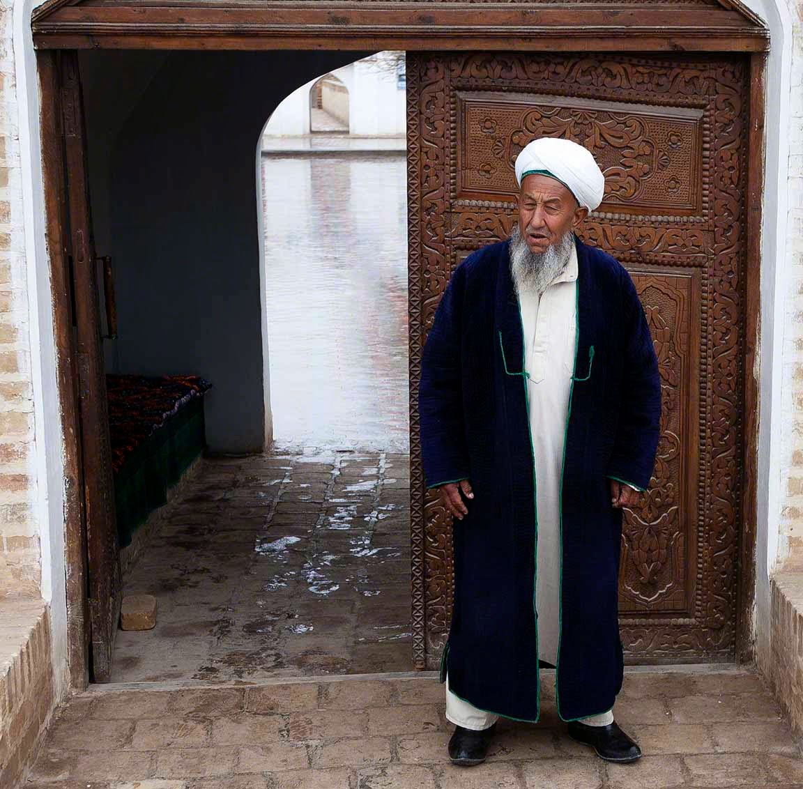
 Graybeard who guards the Mausoleum
Graybeard
Djabbar Khoji, the brother allegedly executed by Chingis Khan, has his own mausoleum deep in the Kyzyl Kum Desert 65 miles west of Qarshi. Although quite isolated, it is an very popular pilgrim destination. The imam in charge of the complex is quick to tell  visitors, quite unbidden, that Djabbar Khoji was killed by order of the great Chingis Khan from Mongolia. 
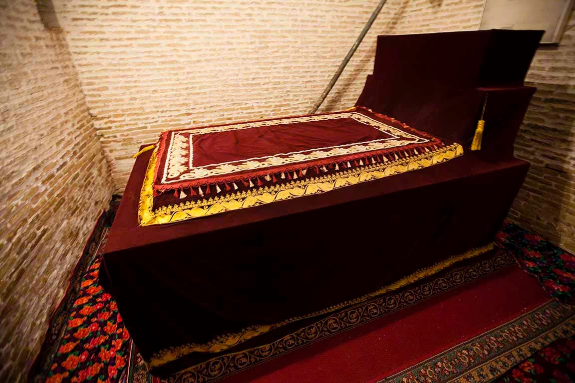
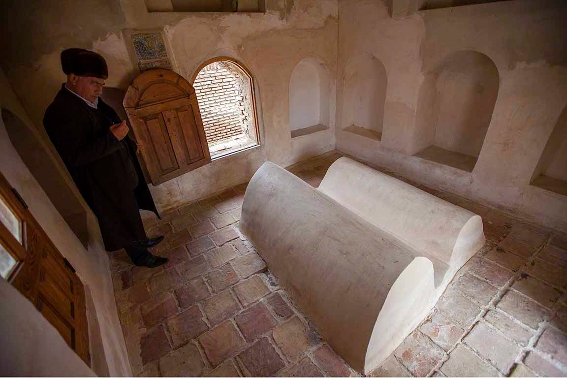
Mausoleum of Djabbar Khoji
Tomb of Djabbar Khoji
 Tomb of Djabbar Khoji
Pilgrims at the Mausoleum of Djabbar Khoji
Viewing all 431 articles
Browse latest View live