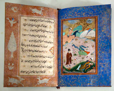
Quantcast
Channel: Don Croner’s World Wide Wanders
Viewing all 431 articles
Browse latest View live

Uzbekistan | Bukhara Oasis | Khwajagan | #5 Samasi

$
0
0
I spent most of the morning tramping around the ruins of Varakhsha, the ancient city on the western edge of the Bukhara Oasis which once served as the seat of the kings of the region. Leaden skies loomed overhead and gusting winds swept snow flurries through the ruined walls and battlements. In the first millennium the city was well within the boundaries of the Bukhara Oasis; now it is on the very edge, with desert stretching off the west. 
Ruins of Varakhsha (click on photos for enlargements)
Shortly after noon we left for the mausoleum of Muhammad Baba as-Samasi. My driver had been to the mausoleum before, but he had gone there directly from Bukhara. He was not quite sure how to get there from the ruins of Varakhsha. We drove north a few miles and found ourselves in the desert.  At a  crossroads we stopped to ask directions from a man passing by on a tractor.
Desert at the first crossroads
The wind had picked up, blowing fresh snow flurries almost vertical across the sand. Following the tractor driver’s directions we soon found ourselves amidst the barren and fallow fields on the cultivated edge of the oasis. We came to crossroads with no idea which way to go. We drove on a couple of miles before encountering a car coming the other way. The driver informed us we were going the wrong way. We had to go back to the crossroads and turn right. We followed the road to the right a couple of miles and came to another crossroad. The last man we talked to had not mentioned this crossroad. We turned right and drove four or five miles until we came to small house set back off the road. We stopped and the driver went to the door to ask for directions. We had taken a wrong turn at the last crossroads. We returned and turned right again. We must have gone through eight or nine crossroads before we finally found ourselves in the parking lot of Muhammad Baba as-Samasi mausoleum. It had taken us an hour and a half to get here, although I later discovered the mausoleum is only eight miles from Varakhsha. 
Western edge of Bukhara Oasis showing Varakhsha and the Mausoleum of Samasi 
My driver, who was wearing only a sports coat, and I hurried through what seemed like gale-force winds from the parking lot to the entrance portal. 
Portal of the Samasi Mausoleum
Shaikh Muhammad Baba as-Samasi, the distinguished student of al-Azizan [Ramitani], was the Scholar of the Saints and the Saint of the Scholars . . . He followed Shaikh Ali Ramitani al-'Azizan and he was constantly engaged in struggling against his self. He was put into seclusion on a daily basis, until he reached such a state of purity that his shaikh was permitted to transmit to his heart from the Unseen Heavenly Knowledge. He became very famous for his miraculous powers and his high state of sainthood. Shaikh 'Ali Ramitani chose him before his death as his successor and ordered all his students to follow him. He used to say, as he passed the village of Qasr al-Arifan, “I am smelling from this place the scent of a Spiritual Knower who is going to appear and after whose name this entire Order will be known.” One day he passed the village and said, “I am smelling the scent so strongly that it is as if the Knower has now been born.”
As we shall soon see, the Knower was Muhammad Bahauddin Shah Naqshbandi, the seventh of the Seven Khwajagan of the Bukhara Oasis
Walkway through the mausoleum complex
Grounds of the mausoleum complex
As we entered the courtyard which contains the tomb of Samasi I noticed a strange thing. There was not a breath of wind. I mentioned to the caretaker that on the way here there here the wind seemed to be blowing thirty or forty miles an hour. We had even encountered strong winds out in the parking lot. But here it was perfectly calm. “This a a peculiarity of this place,” said the caretaker. “It does not matter what the weather is outside; the wind never blows here.”
Tomb of Samasi
Tomb of Samasi
Tomb of Samasi
Tomb of Samasi

Intz
Mosque at the mausoleum complex
Interior of the compound
My driver. He is a life-long resident of Bukhara
As we left to drive back to Bukhara we discovered that out in the parking lot the wind was still howling relentlessly .

Uzbekistan | Bukhara Oasis | Khwajagan | #6 Kulal

$
0
0
Sayyid Amir Kulal (d.1370) was the sixth of the Seven Khwajagan of the Bukhara Oasis.
In his childhood he [Kulal] was a wrestler. He used to practice all of its arts, until he became one of the most famous wrestlers in his time. All the wrestlers would gather around him to learn from him. One day, a man watching him wrestle had the following thought come to his heart: “How is it that a person who is the Descendant of the Prophet  and who is deeply knowledgeable in sharia and tariqat, is practicing this sport?” He immediately fell into a deep sleep and dreamt that it was the Judgement Day. He felt that he was in great difficulty and that he was drowning. Then the shaikh Sayyid Amir al-Kulal appeared to him and rescued him from the water. He woke up and Sayyid Amir al-Kulal looked at him and said, “Did you witness my power in wrestling and my power in intercession?" One time his shaikh-to-be, Muhammad Baba as-Samasi, was passing by his wrestling arena, accompanied by his followers. He stopped and stood there. An evil whisper came to the heart of one of his followers saying, “How is it that the shaikh is standing here in this wrestling arena?” The shaikh looked at his follower immediately and said, “I am standing here for the sake of one person. He is going to be a great Knower. Everyone will come to him for guidance and through him people will reach the highest states of Divine Love and the Divine Presence. My intention is to bring this person under my wing.” At that moment Amir Kulal gazed at him, was attracted and abandoned the sport of wrestling. He followed Shaikh Muhammad Baba As-Samasi to his house. Shaikh Samasi told him, "You are now my son."
Sayyid Amir Kulal’s mausoleum complex is located eight miles east of Bukhara.
Entrance to the mausoleum complex of Sayyid Amir Kulal
Grounds of Sayyid Amir Kulal’s mausoleum complex 
Mausoleum of Sayyid Amir Kulal
Interior of mausoleum. Kulal’s tomb is behind the wooden door.
Grounds of Sayyid Amir Kulal’s mausoleum complex

Mongolia | Zaisan Tolgoi | Fifth of the Nine-Nines | Tavisan Budaa Khöldökhgui

$
0
0
The Fifth of the Nine-Nines—nine periods of nine days each, each period marked by some description of winter weather—begins today, January 26. This is Tavisan Budaa Khöldökhgui, the time when “Cooked Rice Cannot Be Frozen.” I must admit I really don’t understand the definition of this period. It seems to me that cooked rice would be frozen at any temperature below freezing, and we can certainly expect colder temperatures than that during the last week of January and beginning of February. Anyhow, the Fourth of the Nine-Nines was supposed to be coldest of the Nine-Nines, but it turned out to be fairly moderate—yesterday the temperature got up to 6º F. in the afternoon. This morning, the first day of the 5th Nine-Nine, it was a mere 20 below 0º F at 7:00.

As all you Devotees of Sin (the God, not the act) know, the Full Moon occurs tomorrow at 12:39 p.m. This is the Wolf Moon, the winter moon when wolves experience the most hunger. Tsagaan Sar, the Mongolian New Year, begins in seventeen days, on February 11. In case you are wondering, the Tsagaan Sar Countdown Clock on my blog counts down to the New Moon, which actually occurs at 3:20 p.m. on February 10. The Tsagaan Sar celebration starts the next day. As you probably know, this will be the Year of the Female Water Snake.  
When you are out for your pre-dawn constitutional this coming week might want to check out the waning moon gliding by Saturn around February 2nd and 3rd.
Graphic Courtesy of Sky and Telescope

Uzbekistan | Bukhara Oasis | Khwajagan | #7 Naqshbandi

$
0
0
Muhammad Bahauddin Shah Naqshbandi (1318–1389) was the seventh of the Seven Khwajagan of the Bukhara Oasis. He is the eponym of the Naqshbandi Order which exists down to the present day. His mausoleum complex, seven miles east-northeast of Bukhara, is one of the most popular pilgrimages sites in Uzbekistan and is visited by Naqshbandis, other pilgrims, and tourists from all over the world. 
Entrance to the Baqshbandi Mausoleum Complex (click on photos for enlargements)
Entrance to the Baqshbandi Mausoleum Complex
Courtyard of the 17th century Madrassa
Mosque within the complex
Reservoir within the complex
Ancient tree trunk within the complex
Monument within the compound
Within the mausoleum complex with the tomb of Naqshabandi in the distance
The tomb of Naqshabandi
Tomb complex behind the Naqshbandi complex. Buried here are numerous Timurid and post-Timurid potentates.
Tomb complex of Bukhara Panjandrums

Uzbekistan | Bukhara Oasis | Khwajagan | Naqshbandi’s Mother

$
0
0
A third of a mile north-northeast of the Tomb Complex of Naqshbandi, the seventh of the Seven Khwajagan Of The Bukhara Oasis, is the tomb complex of his mother. It is a favorite pilgrimage site for women. 
Mosque dedicated to Naqshbandi’s mother (click on photos for enlargements)
Mosque dedicated to Naqshbandi’s mother
Old stone pedestal and wooden column of the mosque
Although no one on site was able to confirm this I got the impression that Naqshbandi’s mother was buried in the courtyard behind the wooden screen. Women often come here to pray. 
 What I assume is the tomb of Naqshbandi’s mother
 Mosque of Naqshbandi’s mother and reservoir 

Uzbekistan | Bukhara | Bolo Haus Mosque

$
0
0
Bolo-Hauz (Children’s Reservoir?) Mosque was reportedly built in 1712 by the Ashtarkhanid ruler Abul Fayud Khan (1711-47) for his mother, Bibi Khanum. Later it was apparently frequently by the emirs of Bukhara who lived in the nearby Ark.
Bolo Haus Mosque (click on photos for enlargements)
Bolo Haus Mosque
This short minaret was added to the complex in 1917 by Shirin Muradov, a famous Bukhara craftsmen.
 Bolo Haus Mosque
The entryway, or iwan, is a fairly recent construction, added to the mosque's eastern facade 1914-17 by the last Mangit ruler Sayyid Alim Khan (1910-20)
Detail of entrance to Bolo Haus Mosque
The porch in front of the Bolo Haus Mosque. The twenty columns are made from poplar, walnut, and elm wood. 
Porch of Bolo Haus Mosque
Detail of wooden columns of Bolo Haus Mosqueue
Detail of wooden columns of Bolo Haus Mosque

Mongolia | Zaisan Tolgoi | Sixth Nine Nine | Zuraasan Zam Garnai

$
0
0
The sixth of the so-called Nine Nines—nine periods of nine days each, each period marked by some description of winter weather—began yesterday, February 4th. This is Zuraasan Zam Garnai, the Time When the Trail of the Road Appears. This description would seem to indicate a slight warming from the previous Nine-Nines, a time when well-traveled trails become free from ice and snow. We did have a slight warm spell, but now temperatures have dropped again, and it’s calling for Minus 35º F tonight, and minus 40º tomorrow night (for those of you asking for temperatures in Celsius, I have but two words: Bite Me!)Tsagaan Sar is of course next week, and forty below 0 F temperatures are not at all uncommon during this holiday. The next Nine-Nine starts on February 13, and by then we can pretty expect the back of winter to be broken. 

Uzbekistan | Chingis Khan Rides West | Otrar to Bukhara

$
0
0
While the Siege of Otrār was in progress Chingis Khan and his youngest son Tolui led the main Mongol army southwest to Bukhara. With them were Turkish auxiliaries who by then had sided with Chingis. “These fearless Turks,” according to the Persian historian Juvaini, “knew not clean from unclean [i.e., were not Muslims], and considered the bowl of war to be a basin of rich soup, and a held a mouthful of sword to be a beaker of wine.” No mention is made in any of the sources about crossing the Syr Darya, usually a intimidating operation, which leads the Russian Orientalist Barthold to opine that the river was frozen over by the time the Mongol army reached it and that they crossed over on the ice. This could have occurred no earlier than late November or early December. The first major town the Mongols encountered south of the Syr Darya was Zarnuq. “When the king of planets raised his banner on the eastern horizon [at sunrise, to the more prosaic-minded],” Chingis and his army appeared before the city walls, according to Juvaini. The inhabitants retired into the Citadel, closed the gates, and at first were determined to resist the Mongol attack. A man named Danishmand (danishman means “consultant”), either a commander of one of the Turkish auxiliary units or a Khorezmian trader who had attached himself Chingis’s army, was sent into the city to talk some sense into the local panjandrums. After they threatened him with bodily harm, he shouted at them:
 I am . . . a Moslem and a son of a Moslem. Seeking God’s pleasure I am come on an embassy to you, at the inflexible command of Chingiz-Khan, to draw you out of the whirlpool of of destruction and the trough of blood . . . If you are incited to resist in any way, in an hour’s time your citadel will be level ground and the plain a sea of blood. But if you listen to advice and exhortation with the ear of intelligence and consideration and become submissive and obedient to his command, your lives and property will remain in the stronghold of security.
After this verbal onslaught the local dignitaries thought it wise to surrender. But they insisted that Danishmand be held hostage while they negotiated terms with Chingis. If any of them were harmed it would mean Danishmand’s head. First they sent forth a delegation of factotums with gifts for the Mongol potentate. Chingis did not appreciate this gesture. He dispatched a message to the city fathers telling them to quit wasting time and to appear in person before him immediately. Receiving this summons “a tremor of horror appeared on the limbs of these people” and they presented themselves to Chingis forthwith. Without further ado he accepted their surrender and then ordered all the inhabitants to vacate the city. During a headcount young men were singled out and drafted as levies for siege work in the anticipated attack against Bukhara. Then while the people of Zarnuq were encamped on the the plains outside the city the citadel was leveled. Juvaini does not specifically say the abandoned city was looted, but presumably it was. Still, the inhabitants had escaped with their lives and whatever personal possessions they had managed to keep out the hand of the Mongols. After the invaders left the they were free to return to what remained of their city. The relatively benign fate of Zarnuq led Chingis’s soldiers, perhaps Turkish auxiliaries, since the words are Turkish, to nickname the town Qutlugh-Baligh (“Fortunate” or “Blessed” Town).

To reach Bukhara from Zarnuq the Mongols now had to cross a fearsome stretch of the mostly waterless Kyzyl Kum Desert. Normally this would have been a daunting if not impossible march for a large army, but a Turkmen caravan boss in Zarnuq, apparently with a grudge of his own against the Khwarezmshah or perhaps in return for coin of the realm, showed Chingis a secret road from Zarnuq to Nur, the first city south of the desert. After crossing 150 or so miles of desert the Mongol army skirted around the western end of 100-mile long Lake Aidarkul and proceeded another twenty-five miles to Nur. Henceforth the route from Zarnuq to Nur directly across the desert became known as the Khan’s Road (Juvaini tells us that he himself traveled this road years later, in 1251). Again the belief of the Khwarezmshah’s advisors that his army would have an advantage over the Mongols because of their knowledge of local roads and terrain proved false. At least some elements of the local populace were proving to be more than willing to assist the invading Mongols. 

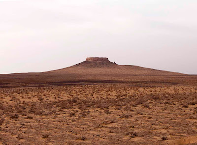
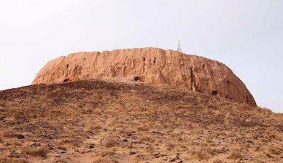
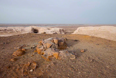
The ancient city of Nur (now Nurata), 210 miles southwest of Otrar, had long served as a strategic outpost on the northern borders of Mawarannahr, a gateway between the nomad-dominated deserts and steppe to the north and the cultivated lands of the Zerafshan River basin to the south. Alexander the Great had arrived here in 327 b.c. and either built or enlarged and strengthened an already existing citadel on a hilltop on the edge of the city, apparently hoping to use the area as a base for further advances into Mawarannahr. 
 Ruins of Alexander the Great’s fortress in current-day Nurata (click on photos for enlargements)
 Ruins of Alexander the Great’s fortress in current-day Nurata
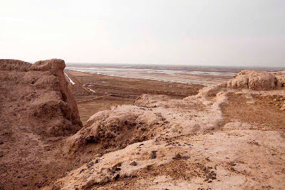
Current-day Nurata from  the ruins of Alexander the Great’s fortress
His men also built a network of underground water pipes, parts of which remain in use down to the present today. One of Alexander’s generals died here and was buried near the base of the citadel, where his tomb can still be seen. 
Tomb of Alexander the Great’s General
The town was also famous for its prodigious chasma, or spring, at the base of the citadel. According to legend the spring was created when the Prophet Muhammad’s son-in-law Ali struck the ground with this staff and water gushed forth. This story is no doubt apocryphal, but the spring—apparently because of its alleged association with family of the Prophet, would by the tenth-century become an important pilgrimage site. Writing in the 940s, the Samanid historian al-Narshakhi, noted: 
Nur is a large place with a grand mosque. It has many ribats [caravanserais]. Every year the people of Bukhara and other places go there in pilgrimages. The person who goes on the pilgrimage to Nur has the same distinction as having performed the pilgrimage [to Mecca] . . . many of the followers of the Prophet are buried there (May God be pleased with them until the day of Judgement).
The Chasma at Nurata
A Mongol commander by the name of Dayir led the Mongol vanguard to Nur. On the outskirts of town they halted in some groves of fruit trees—now barren, as it was Januaryand camped. That night they cut down trees and used the wood to fashion scaling ladders. The next morning they rode up the city walls holding the scaling ladders in front of them The sudden appearance of this Mongol vanguard via a route thought to be known only to merchants caused the watchmen on the walls to mistake it at first for a trading caravan. As the horsemen got closer the watchmen saw the ladders and realized that the mounted men were invaders. The gates of the city wall were thrown shut and the city fathers commenced debating among themselves what course of action to take. After much argument it was decided that they had no choice but to throw in the towel. In Juvaini’s account of the city’s fall no mention is made of the citadel built or upgraded by Alexander the Great. Either it was not longer an active fortification by the thirteenth century or the local panjandrums decided it could not be defended. 

An envoy was sent to Chingis Khan, who was still advancing across the desert with the bulk of his army. Accepting the city’s surrender, he ordering the city fathers to submit to his general Sübetei, who had already arrived at Nur in the wake of the vanguard. Sübetei herded the inhabitants out of town, allowing them to take along only “what was necessary for their livelihood and the pursuit of husbandry and agriculture, such as sheep and cows . . .” He further ordered that “they should go out on to the plain leaving their houses exactly as they were so that they might be looted by the army.” In return for this acquiescence the Mongols agreed not to inflict bodily harm on anyone. 

When Chingis Khan finally arrived in town he ordered the city’s inhabitants to cough up 1500 dinars, the same amount they paid in taxes to the Khorezmshah each year. Half of this sum, we are told, was paid in women’s earrings. The fact that the locals still had dinars to pay, and women earrings to hand over, would seem to indicate that individuals had not been robbed at least of the possessions on their persons, even though the town itself had been sacked and looted. As usual, young men were dragooned as levies, although according to Juvaini only sixty were taken. Compared with the devastation the Mongols would later inflict on cities which resisted them, Nur, like Zarnuq, got off rather lightly, even if the women did bemoan the loss of their earrings. Both cities were essentially sideshows. The big prize was Bukhara, eighty-five miles to the southwest. 

From Nur the Mongol army rode fifteen miles south-southwest through desert-steppe to a 2641-foot high pass, a thousand feet higher than Nur itself, through the Karatau Mountains, themselves part of the Aqtau Range, east-west trending mountains with peaks of up to 5,485 feet. 
Looking north from the 2641-foot pass towards Nurata
To the northeast loomed the snow-covered flanks of the Nuratau Range, with peaks of up to 7116 feet. After crossing the pass they descended onto a strip of grassy steppe where the Mongol horses must have felt right at home. Even if the steppe was covered with snow in late January or early February the sturdy mounts would have had little trouble pawing down to the dry grass, which they must have craved after passing through the bleak Kyzyl Kum Desert. 
Steppe between the 2641-foot pass and the Zerafshan River. The Mongol horses must have thought they were at home in Mongolia.
Fifteen miles from the pass miles Chingis Khan and his army finally reached the cultivated lands along the fabled Zarafshan River. The valley of the river had hosted settlements, towns, and cities (a sedentary societies) for over 3000 years and it had always been the main populous region of Mawarannahr, with the two main cities of Bukhara and Samarkand alternating as the capitals of a long procession of fiefdoms, kingdoms, and empires. The Greeks of the third century b.c. called the river Polytimetus. Also known as the Sughd, or Sogd, River, its lower valley later became the heart of the old Sogdian realm. The current name of Zarafshan comes from the Persian zar-afshān, meaning "the sprayer of gold"), a reference to the gold-bearing sands and gravels found in the upper reaches of the river.

The Zerafshan begins at the Zarafshan Glacier on the Koksu Mountains, themselves outliers of the Pamirs. From its source at an elevation of about 9200 feet the river flows west for about 180 miles, flanked on either side by the Turkestan and Zarafshan mountain ranges. Just below the ancient city of Panjikent the river debouches out onto the plains of Mawarannahr and twenty miles farther on passes by Samarkand. From here it flows about 115 miles east-northwest before turning to the south-southwest and flowing through the Bukhara Oasis. In pre-historic times the river probably drained into the Amu Darya River, but even by the time of Alexander the Great in the third century b.c. it was already petering out in the sands of the Kyzyl Kum Desert southwest of Bukhara.
The Zerafshan River
Crossing the no doubt frozen river the Mongols emerged on the Royal Road, the main caravan thoroughfare between Bukhara and Samarkand. Probably the first town they encountered was Karminiya (current-day Karmana), forty-five miles to the northeast of Bukhara. Known during Sogdian times as Badiya-i-Khurdak (“little pitcher”), the town got its new name from eighth-century Arab invaders who because of the water and soil in the area called it ka-Arminiya, or “similar to Armenia”. Karminiya had been heavily damaged by the Khorezmshah Arslan during his war against the Qara Khitai in mid-twelfth century and apparently did not figure as an important city by the time Chingis Khan arrived on the scene. The mausoleum of Mir Sayyid Barham, built in the late eleventh century during the rule of either the Qarakhanids or Seljuks, is probably the only building in the town to have survived from the pre-Mongol days down to the present.
The mausoleum of Mir Sayyid Barham
About ten miles past the river, where the ancient caravan route swung back out into desert steppe, they might well have passed the famous Rabat-i-Malik, a huge caravanserai built by the Qarakhanid Khan Shams-al-Mulk Nasr (r. 1068–1080). Its 40-foot high portal with elaborate brickwork decoration and enormous walled courtyard signaled that the Mongols were now on the main trunk of the Silk Road, the ancient trade corridor between the Orient and the Occident. The surviving portal and ruins of the caravanserai can still be seen beside the modern highway between Bukhara and Samarkand. 
Entrance to Rabat-i-Malik Caravanserai
Nearby was a huge well of sweet water which would have slaked the thirst of the men and their horses (the brick dome which now covers the well was not added until the 14th century). 
Entrance and Dome of the well at Rabat-i-Malik Caravanserai
After riding another fifteen miles east-southeast the Mongol army finally reached the edge of the greater Bukhara oasis, a forty mile-wide and fifty mile-long swath of cultivated land which in addition to Bukhara itself was home to dozens of small cities, towns, and villages. 
Bukhara Oasis
They probably saw the wall known as “Kanpirak”, measuring over 150 miles in length, which had once surrounded the entire Bukhara Oasis. Kanpirak is supposedly an archaic term for “old woman”, which would at first glance seem an inappropriate term for a wall. One local historian points out, however, that the term “old virgin” might be a more accurate translation, in which case it might connote that the wall was thought to be impenetrable. In any case, the wall was probably built in the fifth or sixth century a.d. Between the years 782 and 830 it was repaired and upgraded as a bulwark against the continuing incursions of nomadic peoples from the north. Maintaining the lengthy wall was an immensely expensive undertaking, however, and required enormous outlays of man-power. At the beginning of the Samanid era in the ninth century Amir Ismael famously declared, “While I live, I am the wall of the district of Bukhara,” implying that he would guarantee the safely of the area by force of arms and that expensive walls were no longer needed. The Kanpirak was henceforth abandoned, and by the time the Mongols arrived it may have been in ruins. In any case, neither Juvaini nor any other Persian historian mentions the wall and it proved no obstacle whatsoever to the Mongol invaders. 

The first settlement inside the wall was the town of Tawais. Formerly known as Arqud, in Persian, or Kut, in Turkish, meaning roughly “fortunate”. Arab invaders renamed it Tawais (“Endowed with Peacocks”) in 710 because it was here they saw their first peacocks—not a native bird of Arabia—in the gardens of the town’s prominent citizens. The town had been well-fortified, but by the time Chingis arrived the local fortress had fallen to ruins, already destroyed in earlier fighting between the various contestants for the Bukhara conurbation. The town was formerly famous of its Zoroastrian temple, although presumably it had disappeared by the thirteenth century, by which time it boasted of a large Friday mosque. Tawais was also famous for its great trade fair, which was held very autumn and lasted for seven to ten days. Merchants from all of Mawarannahr and the Ferghana Valley attended this fair, which operated under one unusual condition: no item bought could be returned, even if it was later proven that the seller had engaged in illegal trickery and deception. Although probably in a hurry to get to Bukhara, presumably the Mongols took time to engage in at least a cursory looting of the town and to dragoon levies for the anticipated lengthy siege of Bukhara. Today Tawais remains as the small village of Tavois, close by the modern town of Kizil Tepe. Now, as in the thirteenth century, it marks the place where the cultivated land of the Bukhara Oasis abruptly ends and the desert steppe begins.
The village of Tavois
Fifteen miles east of Tawais was the town of Vabkent, The Mongols may have homed in on the town’s minaret, visible for miles around on the flat Bukhara Oasis. Commissioned by Abd al-Aziz II, a member of a powerful Bukhara family during the time of the Qara Khitai Khanate (c. 1125–1218), the 127-foot high minaret, completed in 1198–1199, was the second highest in Mawarannahr, after the Kalon Minaret in Bukhara itself, and served as a beacon for caravans and travelers approaching from the north. The Mongols left it unharmed, and it stands to this day, although the mosque it was once attached to has long since disappeared.
Minaret in Vabkent
The eighteen miles from Vabkent to Bukhara was an almost solid procession of towns, villages, gardens, and orchards. Among the more prominent towns were Shargh and Iskijkath (no longer existing under these names) on either side of one of the canals feeding off the Zerafshan River. In the twelfth-century Sultan Arslan, the grandfather of the Khorezmshah ruling at the time of the Mongol invasion, had built a substantial bridge made of burnt brick across the canal connecting the two towns. Both were important trading centers; Iskijkath had a trade fair every Thursday and Shargh every Sunday. An important local trader built a big Friday mosque in Iskijkath, but after imams in Bukhara complained that it was attracting their flocks only one service was ever held in it. No mention is made in the various accounts of the plundering outside of the city of Bukhara, and perhaps the Mongols in their hurry to reach Bukhara hurried on through them, but it is hard to imagine that sometime during their stay in the area these rich market towns were not subject to looting and plunder. 

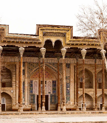
Not long after passing through these towns yet another minaret loomed on the horizon. This was the 155-foot high Kalon Minaret in the heart of Bukhara, the tallest in Mawarannahr. Its appearance signaled to the Mongols that the long-sought after goal of Bukhara was now within their reach. By early February, 1220, Chingis Khan, his son Tolui, and the Mongol army arrived on the outskirts of Bukhoro-i-Sharif—Holy Bukhara.
Kalon Minaret in Bukhoro-i-Sharif

Uzbekistan | Bukhara Oasis | Paikend

$
0
0
In a post about the Early Sogdian History of the Bukhara Oasis I mentioned the ancient cities of Paikend and Varakhsha. I would be remiss if I did not make a few more observations about Paikend, known during its prime as “the city of merchants”, or “the copper town” (apparently for the quality of its copperware). Located at the southern entranceway to the Bukhara Oasis, Paikend may well be older than Bukhara itself, and for much of the first millenium a.d. may have been the more important of the two cities. It was the first major city in Sogdiana north of the Amu Darya River and most caravans that crossed the Amu Darya at Amol would have passed through the city. Through Amol it was linked to Merv in Khorasan and the great Silk Road cities of the Iranian Plateau and Mesopotamia beyond. From the east much of the caravan trade from China, Mongolia, and East Turkestan (now Xinjiang Province, China), would have been funneled through the city. Paikend was also famous for its locally produced silk, glassware, copperware, pottery, armor, and weapons. Chinese, Arab, Indian, Afghani, Persian, and European merchants could be found searching for bargains in the city’s marts and roistering in the less salubrious districts. 
Bukhara-Paikend-Amol Route (click on images for enlargements)
On source suggests that since so many of the men are often out of town on trade missions the city itself was garrisoned at least in part by women. Girls were taught horseback riding and archery from an earlier age.  Finely carved bone rings found in the ruins baffled archeologists for years before it was determined that women wore them on their middle fingers as a guard when drawing a bow string. Famously independent, the women of the city were known to pick out their own husbands and may have engaged in polyandry, a practice not unknown in societies where one husband could be gone for years at a time on trade expeditions and a spare or two would come in handy. 

As mentioned in an earlier post about the Arab Invasions of Sogdiana, Paikend was invaded by Islamic armies in the first decade of the eighth century and thoroughly plundered. Enormous amounts of booty were seized, including armor and weapons the quality of which amazed the Arabs. Ephemeral sources also indicate that numerous gold and silver “idols” were also looted and melted down for their metal. Whether these were Buddhist statues or those of some indigenous religion is not clear. Buddhism was certainly known and probably practiced in Paikend, along with a host of other religions, including Zoroastrianism and Nestorian Christianity. The city did recover and was rebuilt, as demonstrated by the remains of the mosque and minaret built after the Arab conquest. Presumably the city was no longer garrisoned by women after the arrive of Islam. 

The Tenth-Century Historian Narshakhi wrote that the merchants of the city had become extremely rich on account of the trade with China, and that any trader from the region who went to Baghdad was more likely to brag that he was from Paikend than from Bukhara. At one time nearly 1000 ribats, or caravanserais, surrounded the city. The record is far from unclear, but apparently Paikend fell from grace due to the lowering water table which left the city, which sits on a low rise, high and dry. In the early twelfth-century the Khwarezmshah Arslan attempted to revive Paikend by supplying it with water via a new canal, but construction of the waterway proved to be too difficult and the project was eventually abandoned. Today Paikend is in ruins, but traces of its former greatness can still be seen, and if you listen very carefully you can still hear the muted laughter of women from the city’s battlements. 
Watchtowers in the old city wall were located about 180 feet from each other
 Fortifications in the city wall
 Fortifications in the city wall
 Fortifications in the city wall
 Fortifications in the city wall
A residential district within the city walls
Residential district within the city walls
 Ruins of residences
 Ruins of residences
 Ruins of residences. The function of the round hole,which is lined with brick is not clear.
 Remnants of a large wok-like metal structure
 Looking from the residential area toward the Citadel
Ruins of the Citadel
Ruins of the mosque next to the Citadel
 Ruins of the mosque
Base of the minaret next to the mosque. The base is larger in diameter of the still-existing 155-foot Kalon Minaret in Bukhara, which has led some to speculate that it may have been higher than the Kalon Minaret. 
 Floor of the Citadel
 Paving stones on the floor of the Citadel
 Building connected with the Citadel. The purpose of the round hole in the wall is unclear.
 A well near the Citadel. It is now dry. 
 Looking south from the Citadel
 Another residential area
 Ruins of residential area
Ruins of residential area
Archeologists claim this is the ruins of an apothecary. Broken glass and pottery containers with traces of plants and other medicinal substances in them were found here. 
 The main artery through the city leading to the southern gate. It is not entirely clear from the available sources, but it may be that for security reasons city had only one gate—this gate opening to the south.
 Looking north along the the main artery through the city leading to the southern gate
The main artery. Ruins of merchant stalls can be seen to the right.
 Merchant stalls lining the main artery
The main artery from the southern gate of the city. This may have been the city’s only gate.
A high-class residential district, probably inhabited by wealthy merchants, just east of the southern gate. 
 Upper-class residential district. The brick structure may have been a cistern. 
Well in the upper-class district
Ruins of ribats, or caravanserais, just outside the walls of the city at the southern gates. At one time there were close to 1000 of these ribats surrounding the city. 
Locals are still uncovering artifacts from the ruins. This young man has a pottery vessel which an archeologist whom I consulted said was used to store mercury. Apparently there are other examples in museums. Among its many other uses, mercury was used in processing gold, and was exceeding valuable in Sogdian times. Shards of common pottery are found everywhere within the ruins. 
 Detail of pottery vessel
Vineyards outside the ruins of the city walls 

Mongolia | Zaisan Tolgoi | Seventh Nine Nine | Doviin Tolgoi Borlono

$
0
0
The seventh of the so-calledNine-Nines—nine periods of nine days each, each period marked by some description of winter weather—began five days ago, on February 13. The Seventh of the Nine-Nines is Doviin Tolgoi Borlono, the “time when the tops of the hills become brown.” This would seem to indicate that it should be getting a bit warmer and some snow should be melting. I waited five days for this to happen, but now it does not appear that it will. Just yesterday we had fresh snow both here in Zaisan Tolgoi and on the nearby mountaintops. And this morning it is still Minus 26º F. with an expected high today of only Minus 8º F. Next Big Event: Spring Equinox in 30 days!

Mongolia | Zaisan Tolgoi | Moon Apogee

$
0
0
Feeling a bit down? Well, maybe it is because the moon will reach its Apogee today. Here in Zaisan Tolgoi the apogee occurs at 2:21 p.m. At this time the moon will be 251,327 miles away, the farthest it gets from the earth during the current cycle. Tonight the moon will also swing by the top of Orion, which should get all the Egyptologists out of their funk. 
Graphic courtesy of Sky & Telescope
As all you Devotees Of The Moon God Sin know (I’m looking at you, Puabi), the Full Moon is coming up on February 26. And all you Neo-Pantheists (you know who you are) should get your Elk Antler Headgear out of the closet! Is another meteor too much to pray for?

Mongolia | Zaisan Tolgoi | Eighth Nine-Nine | Нал шал болно

$
0
0
The eighth of the Nine-Nines—nine periods of nine days each, each period marked by some description of winter weather—begins today, February 22. This is Нал шал болно, the time when puddles appear on the ground. As the name indicates, it should now be getting warm enough in the afternoons for snow to melt and puddles of water to appear. It was still Minus 20º F. at eight this morning, but the forecast is for a high of 16º above this afternoon. If it actually reaches this temperature it may be the warmest day yet this year. While 16º above F. is of course well below freezing, radiant heat, on black rocks for instance, should be enough to melt snow and ice. So it is quite possible that some puddles will appear this afternoon. In no time at all it will be time for the First Wildflowers To Appear.

Mongolia | Zaisan Tolgoi | Ninth Nine-Nine | Ерийн дулаан болно

$
0
0
The ninth and last of the Nine-Nines—nine periods of nine days each, each period marked by some description of winter weather—begins today, March 3. This last Nine is Ерийн дулаан болно: the time when warm weather starts, signaling the end of winter. The Eighth Nine-Nine, you will recall, was the Time When Puddles Appear. Indeed, several afternoons last week I did notice puddles along the road from my hovel to Zaisan Tolgoi. Yesterday the temperature got up to 28º F. in the afternoon, and today is calling for the same. In fact yesterday afternoon my finely attuned olfactory organs detect a whiff of spring in the air, so we can start looking forward to the next big event in Zaisan Tolgoi, the Appearance of the First Wild Flower.

The Spring Equinox, signaling the arrive of Spring, does not course of course occur until March 20, but with the beginning of the last of the nine Nine-Nines winter, my favorite time of the year in Zaisan Tolgoi, is except for the shouting pretty much over.  So I am out of here!!!

Uzbekistan | Bukhara | Magok-i Attari | Perigee of the Moon

$
0
0
As you are no doubt aware the Perigee of Moon, the moment when the moon got the closest to the Earth during the current lunar cycle, occurred at 4:21 a.m on Wednesday, March 20. This month the moon was 229,878 miles from earth at the Perigee. What better place to observe this month’s Perigee of the Moon than at that the foundations of the old Moon Temple in Bukhara, Uzbekistan? I won’t bore you with the details of how I got from Zaisan Tolgoi in Mongolia to Ubekistan; suffice it to say I  winged off from the Ulaanbaatar airport at 11:50 Monday evening and arrived in Bukhara at 8:55 a.m. on Wednesday morning. After quickly stashing my portmanteau at Komil’s GuesthouseI headed for the former Magoki-Attari Mosque, which apparently stands on or near the foundations of the old Moon Temple. 
Entrance to Komil’s Guesthouse (click on photos for enlargements)
I arrived 9:20 a.m., almost three hours after the Perigee, but no doubt early enough to catch the effects of the afterglow. The old Magok-i Attari Mosque is now a carpet museum, but the tourist season had not yet really begun yet in Bukhara and it was lock up tight.
As can be seen, Magoki-Attari now sits in a depression ten to twenty five lower than street level. The lower level is reached by staircases.
We first learn about this temple in Narshakhi’s The History of Bukhara, written in the 940s during the Samanid era (892 a.d.–999 a.d.), with addendum later added by another author. Although Narskhakhi‘s History is an invaluable source for the early history of the Bukhara Oasis, his accounts are at times less than concise and even muddled. Thus we have to tread quite carefully through his account of the temple that now serves as carpet museum. He speaks first of the market that existed on the site of the temple or grew up around a temple already located on the site. Twice a year, we are told, a fair was held in this market at which idols were sold. He does not specifically say what kind of idols these were but apparently they were dedicated to a moon God named Makh or Mokh. Anyhow, people would come and buy idols to replace ones that had become broken or gotten lost. In just one day of the fair 50,000 dirhams, an enormous amount of money at the time, were spent on these idols. “Everyone bought an idol for himself and brought it home,” Narshakhi tells us. Unfortunately he gives no description of these idols nor does he say how they used by their owners after they acquired them. “Later this place,” he adds, become a fire-temple.” By fire temple he probably meant a Zoroastrian temple, although this point has been disputed. Zoroastrianism was present in Bukhara in the pre-Islamic days of the Sogdians, whose contacts from one end of the Silk Road to the other had also brought them in contact with Buddhism, Christianity, and probably Judaism.
Southern side of Magok-i Attari
The sale of the idols—which we are still assuming belong to some lunar cult—continued after the Zoroastrian temple came into use. “On the day of the fair [where lunar idols were sold], when the people gathered, all went into the fire-temple and worshipped fire”, according to Narshakhi. “The fire-temple existed to the time of Islam [early eighth century] when the Muslims seized power and built a mosque on that place. Today [in the mid-tenth century] it is one of the most esteemed mosques in Bukhara”, according to Narshakhi. 

Amazing enough, the fair at which lunar idols were sold continued on even into Islamic times. Narshakhi tells of one important local Muslim personage who “was very astonished that this should be allowed. He asked the elders and sheiks the reason for this. They said that the inhabitants of Bukhara in olden times had been idol-worshippers. They were permitted to have this fair, and from that time on they had sold idols in it. It has remained thus today.” Thus tradition and custom seemed to override the strict prohibitions against idol worship found in Islam. It is not clear exactly when the sale of idols did stop.

Other sources, some of them admittedly ephemeral, suggest that the temple known as the Mokh (moon) Temple which apparently stood on the site of the later Zoroastrian temple may have served as a cult center for a Moon God originally worshipped in ancient Assyria and Babylonia. This god was known as Sin (or Suen) in the Akkadian language and Nanna in the Sumerian language. The chief centers of the cult were the Sumerian city of Ur in southern Mesopotamia, which dates to a least 5800 years ago, and Harran in northern Mesopotamia. The moon God Nanna was considered the tutelary deity of Ur. The Ziggurat of Ur, which contained the shrine of the moon god Nanna, was built in the 21st century b.c. and its partially restored ruins still stand today. Gradually this cult seeped eastward across the Iranian Plateau and eventually northeastward across the Amu Darya River into Transoxiania, eventually seeding itself in Bukhara. The exact connections between the moon god of Mesopotamia and the moon good apparently worshipped at the Mokh Temple must, however, remain a matter of speculation. In any case, Islamic orthodoxy at some point reasserted itself and the moon cult was stamped out, and by the middle of the tenth-century it was, as Narshakhi noted, one of the most important mosques in Bukhara. 

According to archeological sources, the building stands at the core of the ancient Sogdian city of Bukhara dating back some 2500 years. By the fifth century a.d. the site was occupied by a Zoroastrian Temple and still later by a Buddhist temple, an detail which Narshakhi fails to note. In any case, by the eleventh century the mosque and attendant market was located just south of the Shahristan, or Inner City, Wall, one of two walls around the city of Bukhara proper. Narshakhi mentions that a river ran along one side of the bazaar. This may refer to an old water course now occupied by the Shah Rud Canal, which currently runs along the south side of the mosque complex. 

The name by which the mosque became known is subject to dispute. Some maintain Magok-i Attari means “mosque in the pit” or “the scented pit. The former name refers to the fact that the surrounding area, has been filled in and elevated with the passage of time, leaving the mosque in a depression now from ten to twenty feet lower. The level of the mosque is now reached by flights of stairs from the nearby streets. The name “the scented pit” supposedly refers to the nearby market which by Islamic times specialized in aromatic herbs.

The mosque, especially its southern portal, underwent extensive repairs during the reign of the Qarakhanids in the twelfth century. More restoration and construction was carried out in 1546-7 by the Ashtrakhanid ruler Abdul Aziz Khan. Indeed, most of the present building, with the exception of the southern portal, dates to this time. Additions included the eastern portal, built at street level to allow access to the mosque which by that time was over ten feet lower than the surrounding neighborhood. 
Southern Portal of Magok-i Attari
The ruins of the old bazaar in front of Magok-i Attari. This is presumably the market where the moon idols were sold and later aromatic herbs and other goods. 
 The ruins of the old bazaar in front of Magok-i Attari
 The ruins of the old bazaar in front of Magok-i Attari
The ruins of the old bazaar in front of Magok-i Attari

Uzbekistan | Bukhara | Interior of Magoki-i Attari

$
0
0
After completing the appropriate orisons at Magok-i Attari I wandered through some other districts of Bukhara before heading back to my guesthouse for lunch. Passing once again by Magok-i Attari I noticed that the carpet museum which the building houses was now open so I wandered in. 
In the northeast corner of the building is an archeological digging which has been keep open for public display. Shown here are parts of the ancient walls of building. The lowest level of this excavation dates back to at least a thousand years ago. 
Staircase leading to the eastern portal, which opens onto  the current street level some twelve feet or so above the floor of the structure. 

The eastern portal on the right, with the southern portal on the bottom. The eastern portal was built in 1546-7 by the Ashtrakhanid ruler Abdul Aziz Khan to accommodate for the rise of the surrounding terrain.
The Carpet Museum which now occupies Magok-i Attari
The interior looking upward towards one of the two domes
One the two domes
A typical kilim on display in the museum

Uzbekistan | Bukhara | Jahongir Ashurov | Book

$
0
0
Wandered by the old caravanaserai fronting on  Lyab-i Haus, the main public square in Bukhara. I was looking for Jahongir Ashurov, a miniaturist from whom I had bought  Some Miniatures a few years ago (see More Miniatures by Jahongir Ashurov).
Entrance to the old caravanserai (click on photos for enlargements)
Courtyard of old caravanserai. It now hosts the workshops of various artists and craftsmen, including miniaturists, silk weavers, etc. It was very early in the morning and the courtyyard was still dusted with fresh now. Jahongir was not yet there however.
Another view of the caravanserai. I came back at noon when things had warmed up a bit and found Jahongir in his shop. 
Of note among his new works is a complete book containing a poem by Khoja Akhmet Yassavi (1093 a.d.–1166 a.d.) As you probably know, Yassavi is the earliest known Turkic poet who wrote poetry in a Turkic language, and he founded one of the first, if not the first, Sufi orders among Turkish speaking peoples. In his early life he lived in Bukhara and studied under Abu Yaqub Yusuf al-Hamadani (c.1048-1141), who was also the teacher of Ghujdawani (d.1179)

Every element of this book is made by Jahongir, including the miniatures used as illustrations, the hand-written text (which is Uzbek language written in Arabic script, the marbled end papers, and the binding. To Jahongir’s knowledge, he and his brother, who has done a similar work, are the only people in Bukhara and possibly Uzbekistan who are making books like this. Miniatures and bookmaking are not his only skills. He recently returned from a city near Moscow in Russia where he carved various stone monuments.
The book was bound by by Jahongir with silk board covers and a leather spine
Marbled endpapers handmade by Jahongir
Facing pages of illustration and text
Detail of page above
Two facing pages of text
Facing pages of illustration and text
Two facing pages of text
Facing pages of illustration and text
These are just some sample pages. The entire book is for sale for a mere $4000. I am experiencing a temporary cash flow problem or I would buy it myself. Those of you whose portfolios are bulging from the recent record-high DJIA might do well to diversity into one-of-kind books like this. You can contact Jahongir at jahongir_a@yahoo.com.
Jahongir Ashurov

Uzbekistan | Bukhara | Old Town | Dish Girls

$
0
0
This time of the year in Bukhara the sun rises about 7:00. Every morning fifteen minutes or so before sunrise I leave my guesthouse and wander around the city. There is hardly anyone on the streets at this hour and I pretty much have the place to myself. One morning the city was dusted with fresh snow. I walked through the First Trade Dome and past the old Magok-i Attari Mosque to the Second Trade Dome. The old codger who looks after the tomb of Ahmed I Paran, located inside the trade dome, was there, as he always is come rain, snow, or shine. He studiously ignores all foreigners and I do not bother greeting him
 Trade Dome #1 with fresh snow (click on photos for enlargements)
Trade Dome #2 with fresh snow
Abdullah Khan Tim
 Snow of the domes of Abdullah Khan Tim
From the Second Trade Dome I walked north past theAbdullah Khan Tim and through the Third Trade Dome into the so-called Old Town, located on slightly higher ground just east of the Ark, or Citadel. This is the very oldest part of Bukhara. Archeological findings here date back almost 2500 years. When Chingis Khan invested Bukhara in 1220 most of today’s old town was known as the Shahristan, or Inner City, and was surrounded by a wall. This inner wall was probably destroyed in the sack of the city and the fire which followed, and it is not clear if it was ever rebuilt. The outer wall, around the rabat, or outer city, was rebuilt or repaired, only to the damaged or destroyed again several times until the final version of the Outer Wall, sections of which still remain to this day, was built. 
Street in the Old Town
Wandering down one narrow street I pass by a man who looked to be in his sixties sweeping the snow off his steps with a twig broom. He greeted me in Russian and asked what country I was from. I said I was from America (I am an American citizen although I have not actually lived there in many years). Switching to English he said, “Come in and have tea.” I have never turned down a bowl of tea in my life. He welcomed me into his house and after I had taken off my shoes ushered me into a room furnished with nothing but carpets, a thin pad on the floor, and a low table. Actually, it pretty much like the tea room of my hovel in Ulaanbaatar and I felt very much at home. “Would you like black or green tea,” he asked. Since it was still early morning I said black. “Wait one minute, my daughter will bring you tea.” After a minute or two the door opened and in strode a young women with a tea tray. Much to my surprise, it was one the “Dish Girls” I had met on my previous trip. She was momentarily startled to see me sitting in her home, but quickly recovered. Her sister, who also sells dishes and who I had also met, came and in and sat down. Both young women of course sat on their knees with their shins tucked under them. I find it almost impossible to sit this way and assumed a half-lotus position instead. A full lotus hardly seemed appropriate for morning tea with two young ladies. “Well, this is really a coincidence that I should meet you again,” I offered. “Bukhara is a very small place. It is not strange that we should meet again,” said the first young woman. We then chatted for half an hour about tea (the women allowed that they themselves never drank black tea), carpets (the carpet on the floor  was remarkably like the machine-made wool carpets produced in Ulaanbaatar), the dish business (already a lot more tourists in town this month as compared to this month last year), and of host of other ephemeral topics.

The women said that I must stop by the street where they sell dishes and visit them again. I did not say that I had been avoiding this street. Last time I was in town I had promised them day after day I would buy something and then finally sneaked out of town without getting anything. I had planned to stop by just to say hello near the end of my trip, when they would have little time to cajole me into buying anything, but now I said I would stop by today. 

I continued my peregrinations and at about ten o’clock wandered down the street where the girls sold their wares. This year their dishes were set out right be by the side of the Mir Arabi Madrassa. They saw me coming two hundred feet away and started shouting “Don! Don! Come here, Don!” As I approached one woman with hair dyed a curious shade of orange ran up to me with arms outspread and gushed, “My darling, you are back!” This jest elicited gales of laughter from the other girls, since an old goat like me could hardly be anyone’s darling. The girls get bored standing out here all day, especially on cold and blustery days like this when they see very few tourists, and are eager for any diversions. I guess I qualify as a diversion. They had lots of news. The Queen Bee of the group had gotten married and was quick to show me a photo of her husband on her iPhone. To my amazement her husband was the co-owner and salesman of the Abdullah Khan Tim Carpet Store who I had talked to the day before. I had met him several years earlier when he was working at the different store. Small world! One of her friends pointed out that she was already pregnant, although she had only been married since last November. “Not wasting any time, are you?” I offered. She smiled demurely. Although I talked to the Dish Girls for at least thirty minutes, oddly enough not one of them said a word about buying any dishes. Apparently they had already decided that as a customer I was pretty much of a bust. 
Dishes for Sale
 Breathtaking gorgeous dish girl whose father invited me in for tea
Dish Girl married to the co-owner of the Abdullah Khan Tim Carpet Store on the right and her mouth-wateringly delectable  friend

Uzbekistan | Navroz Holiday | Tower of Silence

$
0
0
As I mentioned earlier one reason I came to Bukhara at this time was to observe the Perigee of the Moon. The other was to celebrate the Spring Equinox. As you all know, the Equinox occurred yesterday, March 20. In Bukhara the actual time was 4:02 PM. Navroz, the so-called Persian New Year, begins today, the first full day after the actual Equinox. This is a big holiday in Bukhara. Although it is now celebrated as an Islamic holiday its roots go back to pre-Islamic Zoroastrianism. According to legend Zoroaster himself, founder of Zoroastrianism, introduced the practice of celebrating the Spring Equinox as Navroz. The Equinox is also significant to various shades of Neo-Pagans, Wiccans, and even some Post-Modern Pantheists (I am looking at you, David Weinberger).

Given its allegedly Zoroastrian origins I thought the best place to observe Navroz was at Chilpak, the so-called Zoroastrian Tower of Silence, located on the banks of the Amu Darya 285 miles northwest of Bukhara. I have been to the Chilpak Tower of Silencebefore, in 2010, and had planned this trip then. 

I hired a car and proceeded to the site on the afternoon of the 19th. That night my driver and I stayed in a truck stop about five miles away from the Tower of Silence. We hired a private dining room with a low table and mats on the floor so that when we were done eating we could just stretch out and rest for the night. The room was $6 a night per person. The magnificent fish dinner we had, however, sent me back $15. That was for one kilo of fish (you order by weight) fresh from the Amu Darya River just a couple of miles away, and all the fixings (bread, pickled tomatoes, fresh onions, pickles, carrot slaw, sour cream, tomato based fish sauce, etc.) plus of course all the green tea you could drink (I will observe a dignified silence about the quality of the tea; this was, after all, a truck stop). 

The next morning at dawn we proceeded to the Tower of Silence. My driver waited in the car while I climbed to the top to perform the appropriate orisons. 
The Tower of Silence from the distance. The structure at the top is man-made (click on photos for enlargements)
The man-made addition to the summit of the hill. The dating is uncertain, but it could well be over 2000 years old.
 Entryway to the top of the man-made structure
 Cult site at the top of the monument. Zoroastrians brought their dead here and left them so that their bodies could be stripped down to the bone by vultures and the desiccating heat of the sun. The bones were later stored in ossuaries. I shudder to think of the scenes that must have been played out here. 
View from the top with the Amu Darya in the distance

Uzbekistan | Khwarezm | Gyaur Qala

$
0
0
Sixteen miles southeast of The Zoroastrian Tower Of Silence are the ruins of Gyaur Qala, or fortress, located right on the banks of the Amu Darya River not far from the edge of the Sultan Uvays Dag Mountains.
Driving through the Sultan Uvays Dag Mountains. This hills (they would not be dignified with the name mountain in Mongolia) are somewhat of an anomaly out here in the generally flat valley of the Amu Darya (click on photos for enlargements)
The founding of Gyaur Qala probably dates to about 400 BC, or roughly 2400 years ago. It was thought to be strategic stronghold guarding the important Amu Darya trade routes to and from Khwarezm, the ancient realm on the lower part of the river and its delta where it flows into the Aral Sea. Given its locale the fortress could have controlled both the land routes on the banks of the Amu Darya and the boat traffic on the river. At its prime of the two north-south trending walls of the fort measuring almost 1500 in length. The northern wall was about 650 feet long. Today only the northern wall and portions of the northwest corner remain. The nearby Janpiq Qala was supposedly sacked by Chingis Khan’s sons Chagatai and Ögedei in the winter of 1220-1221, but there is no record of them attacking Gyaur Qala. It is not at all clear when and why the fort finally was abandoned.
 The Amu Darya from Gyaur Qala
 Northern Wall
  Northern Wall
  Northern Wall
   Northern Wall
   Northern Wall
  
Northern Wall
Northern Wall

 Northern Wall
 Northern Wall
 Northwest corner
 Northwest corner and northern wall
 Northern Wall
  Northwest corner and northern wall
  Northern Wall
Exterior of northwest corner

Uzbekistan | Khwarezm | Janpiq Qala

$
0
0
From Gyaur Qala we drove southeastward 4.5 miles to Janpiq Qala. Built in the ninth or tenth century a.d. during an economic boom in Khwarezm, it was situated on the site of an older fortress dating back to the period between the fourth and first centuries b.c. The walled city, measuring 1500 feet long and up to a thousand feet wide, developed into a substantial craft center with quarters devoted to weaving, stone carving, blacksmithing, and the manufacture of glass and pottery. It was also an important trade entrepôt on the Amu Darya where goods from China, India, Egypt, and the Volga River and Black Sea regions all washed up. Russian researchers have suggested that a large breach in the southern wall was made by the besieging Mongols when they attacked Khwarezm in the winter of 1220-1221, perhaps with a huge battering ram. How much other damage the city suffered at the hands of the Mongols is unclear, but the city did recover and it eventually regained much of its former prominence (the breach in the southern wall was repaired). The city was attacked yet again by Amir Timur (Tamerlane) when he swept through the area in 1388. It never recovered from this onslaught, but the substantial ruins of the fortress and citadel walls have survived to the present day. 
Janpiq Qala (click on photos for enlargements)
Eastern wall of the fortress

Tower at the northeast corner of the fortress
Northern Wall
Northern Wall
Western Wall
Western Wall
Remains of tower in the wall
Eastern Wall
Tower in Eastern Wall
Outside of wall showing the opening allegedly made by the Mongols
Inside of wall showing the opening allegedly made by the Mongols
Entranceway from the outside
Entranceway from the inside
Southern Wall
Interior of the fortress 
 Ruins of Citadel 
 Ruins of Citadel 
 Ruins of Citadel 
Ruins of Citadel
Viewing all 431 articles
Browse latest View live